Posts Tagged ‘Highway 1’

Point Lobos State Natural Reserve

Point Lobos State Natural Reserve, or to most simply, Point Lobos, is a one of the major protected nature sanctuaries of the central California Coast.  In addition to the remarkable natural beauty of the point, for many, including yours truly, Point Lobos represents the northern boundary of the great state of Big Sur.

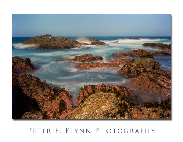
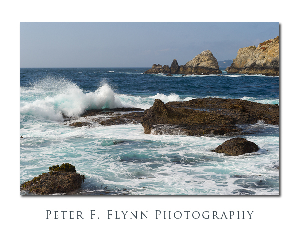
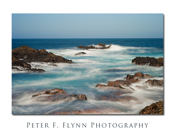
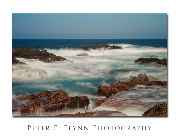
The image above, as well as the two that follow, were recorded at noon, April 10, 2011, using the Nikon D3s and the AF-S NIKKOR 24-70mm f/2.8G ED lens.  Exposures were f/13 or f/14 at 2-3s, ISO 200.  The images immediately above and below were shot at 62mm, whereas the second image below was recorded at 32mm.  Approximate coordinates of the site were 36°31’07.91″N, 121°57’14.33″W.

The entrance to Point Lobos SNR is located a couple of miles south of Carmel-by-the-Sea, on Highway 1 (aka, the Cabrillo Highway).  The entrance fee to the Reserve is $10, which includes a very good map of the area, but entrance à pied is gratis – this accounts for the crowd of vehicles lining Hwy 1 near the Reserve entrance.  Hours are 8 am until 30 minutes after sunset.  A Google Maps link to the area may be found here.

The three previous images were recorded with the assistance of the Singh-Ray Vari-ND filter.  I used the thin version of the filter with 77mm mount.  I’m happy with these images, but this piece of gear can be challenging to work with in conjunction with wide-angle lenses – much more so than you might imagine.  To be fair, the Singh-Ray literature does clearly indicate that there are limitations to appearance of vignetting and other weird irregularities on full-frame camera + wide angle lens setups (an ‘X” pattern appears on a number of images recorded in this shoot – the image immediately above reveals this artifact a bit).  You definitely need to chimp any images shot with the Vari-ND.
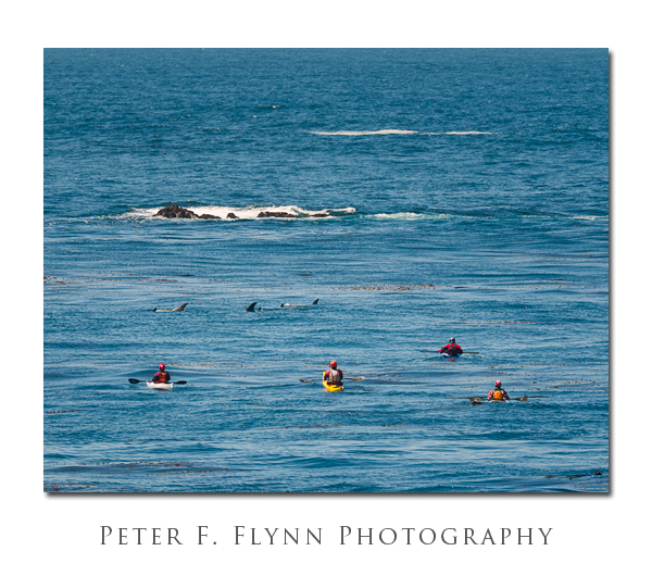
The image above of kayakers and a pod of Risso’s Dolfins was recorded at on April 10, 2011, at 14:00 PST, using the NIKON D300 and the AF-S VR Zoom-NIKKOR 70-300mm f/4.5-5.6G IF-ED lens at 300mm (450mm FX equivalent).  Exposure was f/8.0 and 1/640s (+0.33 EV), ISO 200.  Exposure normalized in ACR 6.4.  This image was shot from the trail above Sand Hill Cove at approximate coordinates 36°30’55.95″N, 121°56’53.97″W.

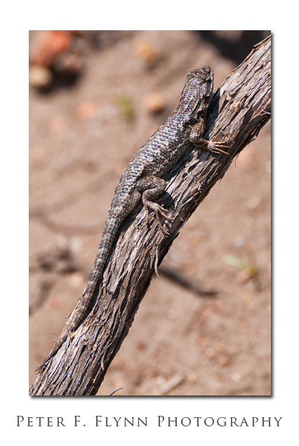
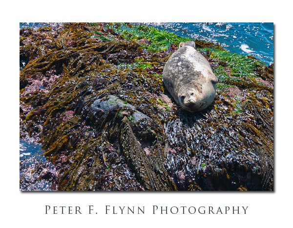
The images above of the lizard, and of the Harbor Seal below, were recorded at on April 10, 2011, at 14:30 PST, using the NIKON D300 and the AF-S VR Zoom-NIKKOR 70-300mm f/4.5-5.6G IF-ED lens at 300mm (450mm FX equivalent).  Exposure for the lizard image was f/8.0 and 1/500s , ISO 200.  Exposure for the Seal image was f/8 and 1/250s, ISO 200.  Both images were shot from a point where the trail climbs above the little inlet at the back of the Sand Hill Cove.  Approximate coordinates of the site were 36°31’53.97″N, 121°56’57.85″W.

Yes, I do carry polarizers with me at all times, but I use them sparingly.  I’m not particularly hung up on absolute authenticity, but honestly, for me specular reflection can be part of the magic of the scene.  Thus in the image of the basking Harbor Seal above I consciously left the polarizer off the lens to capture the high key of the scene.

One more image of the most excellent surf at Sea Lion Point.  Fair thee well Point Lobos, and I’ll see you in two years.

All images were processed in Photoshop CS5 with capture and output sharpening conducted using Pixel Genius Photokit Sharpener 2.0.1, and contrast, saturation and local adjustments conducted using Nik Software Viveza 2 and Color Efex Pro 3.

Copyright 2011 Peter F. Flynn. No usage permitted without prior written consent.  All rights reserved.

Best Luck: Highway 1 Closed

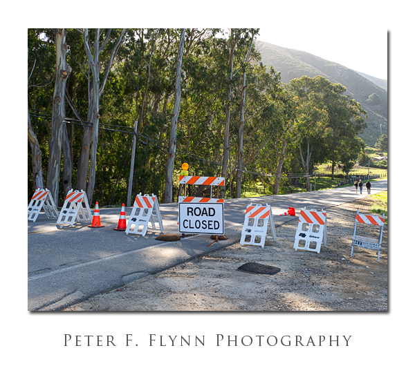
On the afternoon of March 17, 2011, at a point about 12 miles south of Carmel, all of the southbound lane and much of the northbound lane of the Cabrillo Highway (Hwy 1) were washed into the sea by a major landslide.  The cause of the slide has been attributed to unusually heavy rains through the month of March.  Efforts to stabilize the road, which would also provide one-lane passage through the slide area are predicted to take until Mid-May.  Complete repairs are predicted to take a year (!).

The sign and barricades shown above are located at the junction of the Cabrillo Highway and Palo Colorado Road near Notleys Landing – this is as far south as one can currently drive along the coast road.  Coming from the south, the road is closed at the Bixby Creek Bridge.  The image above was recorded at 08:50PST on April 10, 2011, using the Nikon D3s and the AF-S NIKKOR 24-70mm f/2.8G ED at 31mm.  Exposure was f/11 and 1/40s, ISO 200.  Coordinates at the site are 36 23.9564N, 121 54.2812W.

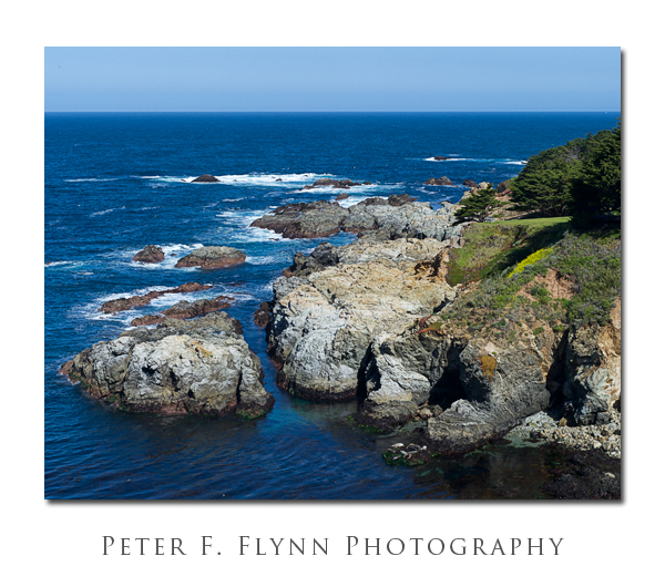
Close inspection of the image above reveals a small group of Sea Lions lounging on the rocks (lower right).  This image was recorded on April 10, 2011, at around 9:15 PST, using the Nikon D3s and the AF-S VR Zoom-NIKKOR 70-300mm f/4.5-5.6G IF-ED at 70mm.  Exposure was f/11.0 and 1/320s (+0.33 EV), ISO 200.  Exposure was normalized using ACR 6.3.  Coordinates of the capture site were 36 24.6968N, 121 54.8634W.

The image of the rocky California coast was recorded on April 10, 2011 at 09:30 PST, using the Nikon D3s and the AF-S VR Zoom-NIKKOR 70-300mm f/4.5-5.6G IF-ED at 70mm.  Exposure was f/11.0 and 1/200s (+0.33 EV), ISO 200.  Exposure was normalized using ACR 6.3.  Coordinates of the capture site were 36 25.9749N, 121 55.1079W.

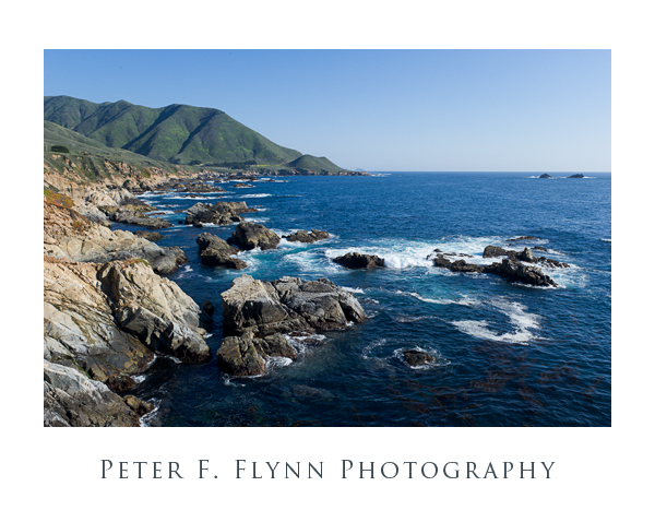
The image above, looking south towards Point Sur, was captured on April 10, 2011 at 14:00 PST, using the Nikon D3s and the AF-S NIKKOR 24-70mm f/2.8G ED at 28mm.  Exposure was f/11 and 1/200s, ISO 200.  Coordinates were 36 28.11378N, 121 55.96390W.

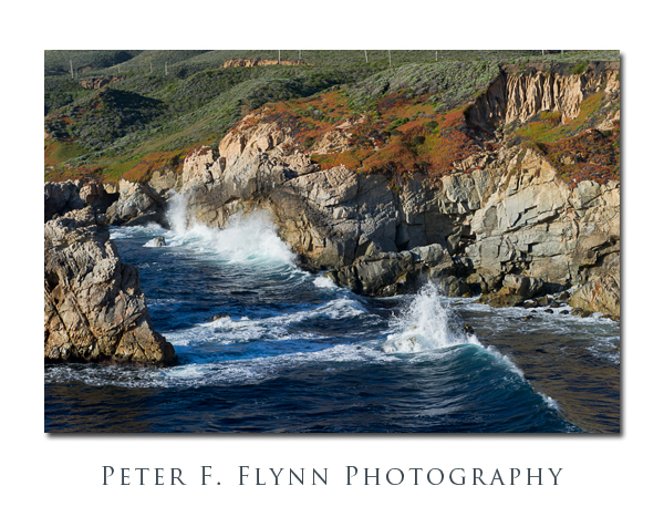
The image above was recorded at 17:00 PST on April 10, 2011, using the Nikon D3s and the AF-S NIKKOR 24-70mm f/2.8G ED at 62mm.  Exposure was f/14 and 1/125s, ISO 200.  The f-stop was selected to arrange a shutter speed of 1/125s, just about right to produce a natural rendition of the waves crashing on the coast headlands.  Coordinates of the location were 36 27.36351N by 121 55.54688W.

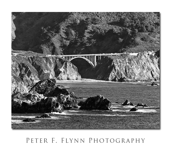
The BW image above shows the Bixby Creek Bridge.  The source image was shot on April 10, 2011 at 14:40 PST, using the AF-S VR Zoom-NIKKOR 70-300mm f/4.5-5.6G IF-ED at 300mm.  Exposure was f/8 and 1/250s, ISO 200.  The (always present) haze made the color version of the image pretty weak, but I was able to boost the contrast using Nik Silver Efex Pro 2 to create a reasonable rendition.  Close inspection reveals a number of vehicles parked on the bridge.  Image recorded from coordinates 36 24.1745N by 121 54.5572W, which is just off of Hwy 1 above the Rocky Point Restaurant.

So, about the title of this entry…what ‘Best Luck’?  The challenge of working the Big Sur coast has always been what to emphasize.  Frankly, I’ve always thought that every inch of the place was just about as lovely as the next.  Nevertheless, being the irrepressible adventurer, I cannot resist the urge to wander.  The end of the road helped me to settle in and focus on the very photogenic northern section of the coast highway.

Excellent images of the washed out section of the Cabrillo Highway can be found here.

Copyright 2011 Peter F. Flynn. No usage permitted without prior written consent. All rights reserved.
Postcards from Big Sur

Highway 1 running south from Pacific Grove to Gorda is one of the most lovely sections of road anywhere on the planet.  Big Sur country.  Big history.  Padre Junipero Serra and members of his mission landed at Monterey in 1770.  Missionaries exploring the headlands and beaches south of Monterey subsequently named the region El Pais Grande del Sur, which in our casual age we have shortened to to El Sur Grande, or Big Sur.

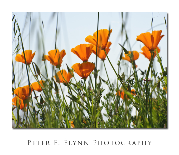
California Poppies

The image above, of California poppies, was recorded on March 30, 2009, at about 16:00 PST, using the Nikon D700 and the AF-S VR Zoom-NIKKOR 70-300mm f/4.5-5.6G IF-ED at 112mm.  Exposure was f/16 at 1/250s, ISO 200.  You’ll find these poppies along the roadside just about everywhere at this time of year.

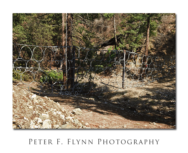
Ravine with Ring Fence

The Big Sur coast area was decimated this past year.  First by fire last summer, and then by heavy rains this winter.  Much of two of the major State of California parks in the area – Pfeiffer Big Sur and Julia Pfeiffer Burns – have been closed indefinitely due to damage and/or repair of damage resulting from the fire/erosion.  The image above shows the fence guards that have been placed at the mouths of many of the ravines along the Big Sur coast.  From both relatively narrow; 20ft wide exits, to the large, 75ft wide exit shown above, fences constructed from interlocking wire hoops have been installed – presumably – to prevent debris from crashing onto the roadway in the event of a flood.  The image was recorded on March 30, 2009, at 16:20 PST, using the D700 and the AF-S NIKKOR 24-70mm f/2.8G ED at 45mm.  Exposure was f/16 at 1/250s, ISO 200.

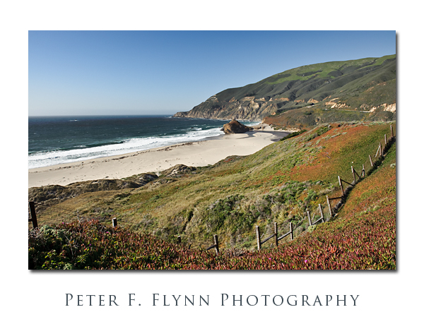
Big SurNot all is lost of course.  The headlands are beautiful as ever, viewed from the road and from the many turnouts along the highway.  The image above demonstrates this quite nicely I hope.  The shot was recorded on March 30, 2009, at about 17:00 PST, using the D700 and the AF-S NIKKOR 24-70mm f/2.8G ED at 24mm.  Exposure was f/16 at 1/125s, ISO 200.
Big Sur Cow Pasture

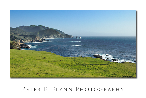
The image above, of perhaps the world’s most beautiful cow pasture – I’m not joking – there are dozens of cows roaming around just out-of-frame – was recorded on March 30, 2009 at about 17:25 PST.  The image was captured using the Nikon D700 and the AF-S NIKKOR 24-70mm f/2.8G ED at 40mm.  Exposure was f/16 at 1/100s, ISO 200.  By now you’ve guessed that I’ve figured out that this lens rocks the casbah at f/16 – yeah, it really does.

I understand that those of you who have some keeness for sport driving may be drawn here for the challenge.  The roadbed does seem well-banked in the kooky manner of wistful engineers, and depending on the calendar, I would guess that traffic could be light.  This would not the spot for amateurs however, since reaction errors in the subsecond range can launch you into the deep blue sea – or so I am told.  Oh, and the area does get a daily drive through by the CHP, again, as I am told, since I have no personal experience in such dangerous activities.  Please don’t harass gramps and granny; who you will surely meet here, sooner or later – they’re lovely folks.  More importantly, they’ve earned the right the drive at any damned speed they fancy – even if it does does mess up your righteous manual shift test of the Pontiac G6 tranny!  Finally, and again this would only be -if- you did have some enthusiasm for driving the Big Sur road at thrilling, no, I meant dangerous, dangerous speeds – then I would suggest that your pre-drive preparation might profitably include a little prayer to Padre Serra – Dude, he’s almost a Saint.