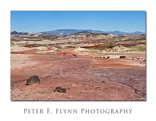
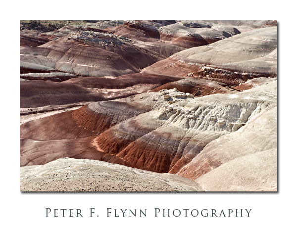
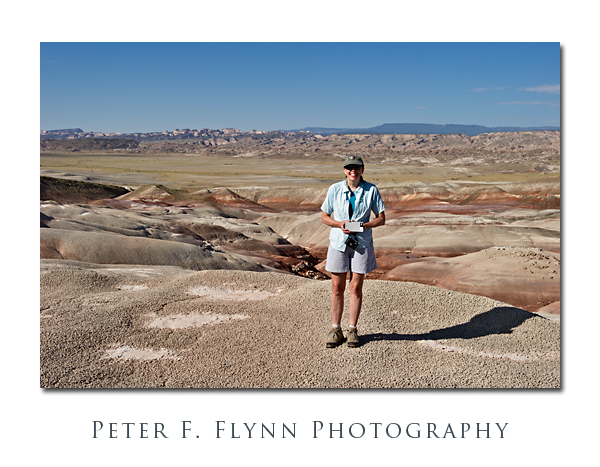
Capitol Reef National Park, UT. Given the vast area, it is simply not possible to photograph the entirety of the Cathedral Valley in favorable light in a single day. Yes, I know, I said that you don’t always need the light of the golden hour to render compelling images, but there are practical limitations. I believe that Cathedral Valley can be well-covered in two days, provided that weather and road conditions cooperate. As I have observed in a previous entry, I believe that the preferred route starts at Caineville, at the opposite end of the ‘standard’ loop, which provides a formula for obtaining images of the lower Cathedral Valley or the western sections of the upper Cathedral Valley. The significant missing element of this strategy is the opportunity to create morning-light images of the southeastern sector of the Cathedral Valley, and most notably, The Bentonite Hills along the Hartnet Road.
According to the Park geology website, the Bentonite Hills are part of the Brushy Basin shale member of the Morrison Formation, laid down in the Jurassic Period, from 156 to 147 million years ago. The formation is characterized by low-lying smoothly-contoured hills, with bands of color that may include blues, greens, reds, and violets. Bentonite is a silicate clay formed from volcanic ash that may include aluminum, calcium, potassium, and/or sodium. Close up, the surface is rough and broken in what some has characterized as a popcorn-like appearance. If there was ever an expanse that deserved the name ‘badlands’, The Benonite Hills is it. Hardly a thing grows anywhere, not even exploratory shoots.
The Hills are most easily reached from the ‘standard’ route around Cathedral Valley, starting from the Fremont River ford. The Fremont is a modest stream under normal conditions, and is usually easily crossed. The road winds upward in to The Bentonite Hills, gaining perhaps a few hundred feet in a half-mile, entering the lower Cathedral Valley. The Hills are about nine mile west of the river crossing, along a gravel road that can be traveled in all but the most inclement conditions. The road leads pretty much straight though the middle of the formation, so that compelling images can be made looking north/south-eastward (morning) or north/south-westward (late afternoon).
Note that bentonite readily absorbs water (up to many times its own dry weight), and consequently the material becomes impossibly sticky when wet. Thus, travel through The Bentonite Hills should not be attempted during or shortly after significant rain.
The images above were recorded at around 09:00 MDT on July 25, 2010, using the Nikon D3s and the AF-S NIKKOR 24-70mm f/2.8G ED lens at various focal lengths. The 24-70mm it is remarkably sharp at all focal lengths. A major critique is that it lacks VR – but I do not believe that this is a serious shortcoming. I find this range, 24mm-70m, to be very serviceable in the field.
Copyright 2010 Peter F. Flynn. No usage permitted without prior written consent. All rights reserved.


