No, not that Deva… Not the God, actually Gods, of Hindu mythology. I mean DEVA, as in the four-letter Alpha Code (*) the National Park uses as an abbreviation of the full park name, Death Valley National Park.
Please select the thumbnail to see the full pano…
The pano above, of the HP at Dante’s Point, was recorded on March 24 at 9:00 PDT, using the iPhone5 (iP5). Exposure was f/2.4 and 1/2500s, ISO 50. I’m still getting used to these iP5 exposure stats… Note that while this is not the best composition, it includes the HP, which is more than enough to recommend it as an excellent pano!
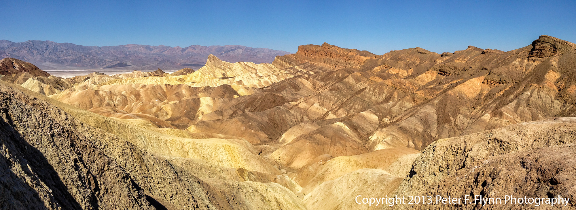
The pano above of the Zabriske Point experience was recorded at 10:30 PST using the iP5. Exposure was f/2.4 and 1/3400s, ISO 50.
Right, so we began the day at Dante’s View, then back down Dante’s View Road to Furnace Creek Road, and further on to CA SR-190. Then along SR-190 north past Zabriske Point, and then Furnace Creek. Staying on 190, we headed west past Stovepipe Wells, then across the salt pan to Emigrant, and then Panamint Springs, finally stopping at Father Crowley Point/Vista.
The view from Father Crowley’s Vista, shown above, is definitely one of the best views in the park – it is relatively peaceful here, far from the madding crowd. Images recorded at 13:00 PST. This image is pas tout à fait prêt à porter – I’ll work it on luminance and contrast and repost ASAP…
Father Crowley Vista was as far east as we traveled on this visit. We then returned back along SR-190. The image above, recorded at around 14:00 PST, was shot looking east from the east side of Panamint Springs.
On the morning of March 25, we traveled from out hotel in Furnace Creek to Stovepipe Wells to shoot the Mesquite Flat Sand Dunes at sunrise. The weather did not cooperate, and the sun was behind a heavy shield of clouds, but I managed to shoot the pano above. Image recorded at 8:00 PST.
Having been disappointed at Stovepipe, we headed back south towards Badwater. Along the way we stopped at the Devil’s Golf Course, shown above. Image recorded at 10:13 PDT. The intermittently cloudy sky gave us a bit of drama in this shot.
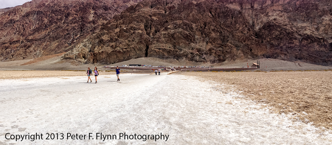
Continuing south along the Badwater Road, we reached Badwater Basin at around noon, see above and below.
(*) Alpha Codes for parks that have a single title name, like Yellowstone, are generated using the first four letters, e.g., YELL. For parks with names consisting of two or more words, like Death Valley, the code is generated using the first two letters of the first two words in the name, e.g., DE + VA = DEVA. BTW, unlike the Deva of Hinduism, which is generally benevolent, DEVA, as we have seen in this entry, is a hostile place for man and beast alike. On the other hand, using YELL for something as cool as Yellowstone is a bit lame – we should use a tough name like STONE, as in ‘Yeah, I just got back from a week up in the STONE…’ Right, as usual, another discursive blog entry!
Feliz 5 de mayo!
Copyright 2013 Peter F. Flynn. No usage permitted without prior written consent. All rights reserved.


