Posts Tagged ‘Dead Horse Point’

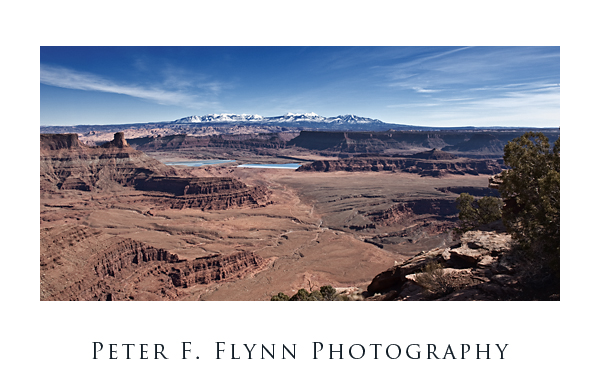
La Sal Mountains and Shafer Basin

La Sal Mountains and Shafer Basin

Wandering north about 0.5 miles from the Dead Horse Point Overlook we encountered a most excellent view of the La Sal Mountains with Shafer Basin in the foreground.  Lying at the bottom of the basin are the Potash Solar Evaporation Ponds.  Potash; which is potassium carbonate, was originally mined in the basin using conventional underground methods.  After 1970 salt extraction was converted to solution mining.  Colorado river water is pumped into the mines and the resulting saline solution is directed into the evaporation ponds, which possess an unworldly deep blue color.  An excellent article on the geology of of Dead Horse Point and vicinity has been written by Deolling and Chidsey of the Utah Geological Survey.

The image was recorded at about 7:30 am on February 15th using the Nikon 700 and the AF-S NIKKOR 24-70mm f/2.8G ED lens at 24mm.  The exposure was f/18 at 1/125s, ISO 200.

In addition, panning just slightly north we have a shot of the HP practicing her arts on the rim trail.  Yeah, she does seem to be wearing several layers- although it was sunny, it was pretty chilly with updrafts all around the rim.
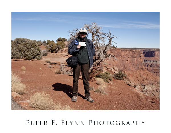
The High Priestess at Deah Horse Point

Dead Horse Point

Dead Horse Point State Park is adjacent to the Island in the Sky District of Canyonlands NP, about 18 miles south on SR313 from the junction with US191 (15 mile southeast of Moab as the crow flies).   The road out to Dead Horse Point Overlook passes through a narrow (30 ft) wide section know as The Neck that connects the point to the rest of the mesa.  Cowboys herded wild mustangs by driving them through the narrow passage which was then closed by a fence.  The name of the park is attributed to the death by dehydration of a herd of horses that were left on the point.

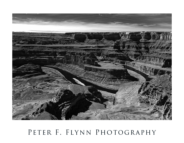
Colorado River from Deah Horse Point

A rim trail circumnavigates the point, providing a number of excellent viewpoints, including the Pyramid Canyon Overlook at the north end of the park; the Visitors Center overlook; the Basin Overlook about 0.5 miles south of the Visitor’s Center; Dead Horse Point Overlook at the southern tip of the point/park;  Meander Overlook  just west of The Neck; Shafer Canyon Overlook, which is about 1.5 miles north on the rim trail from Meander Overlook; Rim Overlook, approximately 1 mile north of the Shafer Canyon Overlook; and  Big Horn Overlook about 2 miles north on the rim trail from the Rim Overlook.

The IR image of the Colorado River from the Dead Horse Point Overlook was made at about half past noon on February 15, 2009, using the Nikon D200IR and the AF-S Zoom-NIKKOR 12-24mm f/4G IF-ED at 24mm.  Exposure was f/16 at 1/20s, ISO 100.