Posts Tagged ‘Capitol Reef National Park’

Strike Valley Overlook

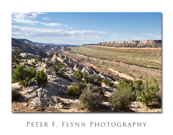
One of the highlights to a visit to Capitol Reef National Park is a drive south along the Notom-Bullfrog Road (NBR).  The NBR heads south-southeast from the junction with Utah Highway 24 (about 9 miles east of the Visitors Center), and slips along the margin between the Waterpocket Fold and Strike Valley.  At about 34 miles from the junction of the NBR and UT24, you reach a junction that heads westward up the Burr Trail Switchbacks.  A short drive west from top of the switchbacks brings you to the Upper Muley Twist Road that heads north along the Waterpocket Fold.  From the end of the road a short hike eastward brings you to a world-class perch, the famous Strike Valley Overlook – seriously, I’ve walked all over the west, this may be THE place.

To be precise, a ‘strike valley’ is a common geological formation found most anywhere immediately adjacent to a significant fold or upheaval.  What we are talking about in this entry however is among the best examples found anywhere.  This strike valley runs along the southern portion of the Fold from Cedar Mesa Camp about 11 miles south of UT 24 to the southern margin of the Park.  The overlook grants views of the Strike Valley north and south along the Waterpocket Fold, and east to the Henry Mountains.

The image above was recorded at 18:00 MDT on July 24, 2010, using the Nikon D3s and the NIKKOR AF-S 24-70mm f/2.8G ED lens at 42mm.  Exposure was f/16 and 1/200s (+0.33EV), ISO 400.  Coordinates of the site are 37,52.9900N/111.2.5372W.

The overlook may also be reached from the west, by traveling east 26 miles out of Boulder, UT.  The Burr Trail Road is paved from Boulder to about 5 miles before the switchbacks.  On this visit we executed a loop trip back along this route to Boulder, and then north to Torrey, UT, along the magic UT Highway 12.

A few important suggestions.  It would be an excellent idea to stop by the Visitors Center and chat with the staff about road conditions.  Be aware that Park Staff are programmed to speak from a ‘better safe than sorry’ perspective, however this truly is a remote region with no water, and challenging driving conditions.  The NBR is paved for the first 5 miles south from the junction with UT24, and then converts into dusty washboard south of that point.  As is true most everywhere in south-central UT, roads in wet to very wet conditions are impassable, as in if you attempt to move you will slide off of the road, or become stuck in thick mud.  The Burr Trail switchbacks are steep, but perfectly safe in dry conditions – they might be a bit of  thrill for those with little backcountry driving experience.  The Upper Muley Twist Road cannot be safely navigated by a low-clearance vehicles, although 4WD is probably only necessary in wet conditions.  I also predict that very large pickups and wide vehicles (think Hummers) will have to execute some tricky moves to make it to road’s end (we drove a Toyota Tacoma with the crew-cab and associated short-bed).

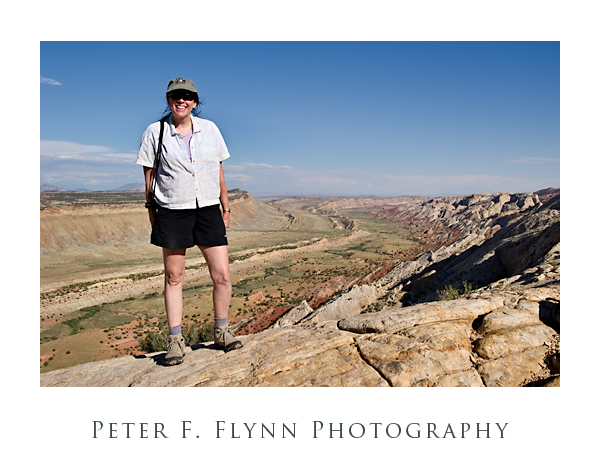
Finally (below), a shot of The HP, and the southern view into the Strike Valley.  The image was recorded using the D3s and the 24-70mm lens at 32mm.  Exposure was f/16 and 1/400s, ISO at 400.  Handheld.  You could not deduce it from her calm and relaxed appearance in the image, but the HP was the most awesome support ever – carrying a 20lb camera bag and tripod while chasing a panicky photog back and forth along a 200 meter section of the Fold in the failing light.

Copyright 2010 Peter F. Flynn. No usage permitted without prior written consent. All rights reserved.
Glass Mountain

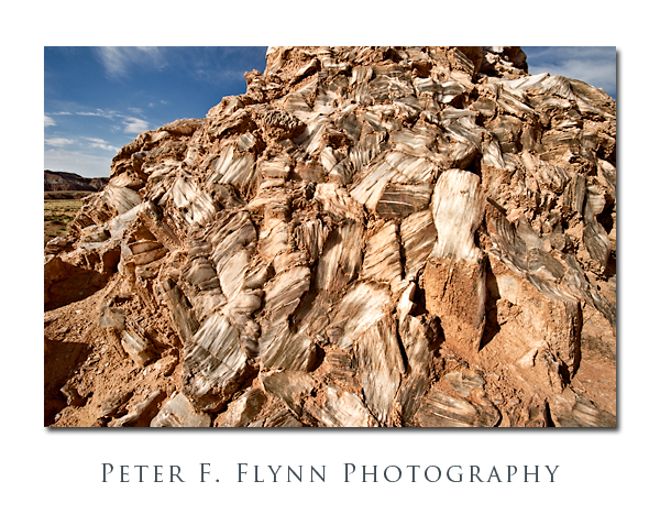
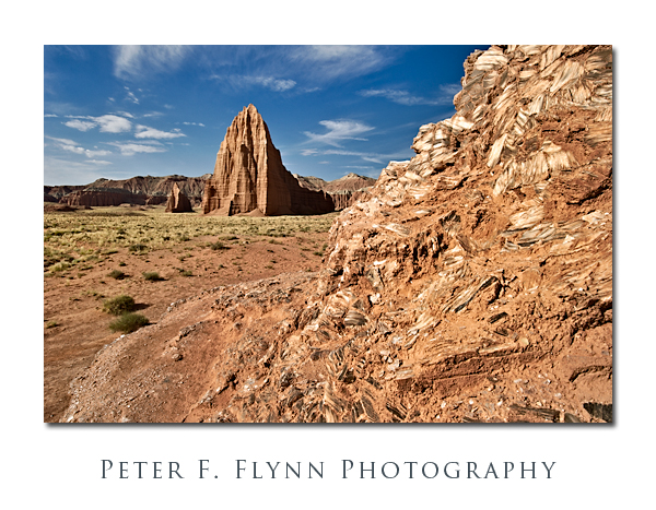
It’s not really made of glass, of course, but if you are traveling in the Cathedral Valley of Capitol Reef National Park, the exposed mound of selenite crystals (gysum) is definitely worth a stop.

Glass Mountain is located about 0.5 miles north of the Temple of the Sun along a road that splits off from the path that leads to the Temples.  The Mountain is a jumble of large crystals that rise about 20 feet from the valley floor.  There is a fair amount of clay covering the crystals, and as shown below, there is likewise a significant amount of inclusions within the milky white crystals themselves.

Images of Glass Mountain were recorded at around 09:15  on July 23, 2010, using the Nikon D3s and  AF-S NIKKOR 16-35mm f/4.0G VR ED at the 20mmk (first image) or 16mm (2nd image).  Exposure was f/16.0 and 1/250s or 1/400s, ISO 400.

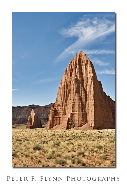
In addition to the obvious setup with Glass Mountain in the foreground and the Temple of the Sun and the Temple of the Moon in the background, this spot is also an excellent location from which to make a medium telephone shot of the Temples alone as shown below.

The image of the Temples of the Sun and Moon was recorded using the AF-S NIKKOR 24-70mm f/2.8G ED lens at 52mm.  Exposure was f/16.0 and 1/80s, ISO 200.

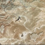
GPS coordinates of the site are 38° 27.2863′ N, 111° 11.5066′ W.  A Google-Earth image of the site is shown below:

Copyright 2010 Peter F. Flynn. No usage permitted without prior written consent. All rights reserved.
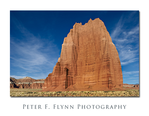
Temple of the Sun, Temple of the Moon

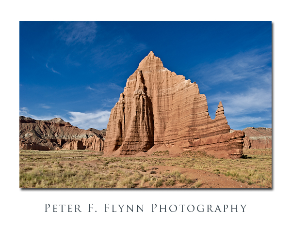
The Temple of the Sun and The Temple of the Moon are found near to one another in the most beautiful and remarkable Cathedral Valley District of Capitol Reef National Park.  The area is most easily reached from the Cainville Wash Road (about 18.5 miles east of the Visitor Center), which may be accessed by traveling east from nearby Torrey, the Park Campground, or points in the vicinity along Highway 24.  Although these natural cathedrals can be reached by traveling the commonly suggested route from the (Fremont) River Ford Crossing, e.g., clockwise around the Loop Road, if you will want to visit them during morning light (as you certainly should), then you must approach from Caineville.

The Temples are the first in a series of remarkable sights that await visitors traveling the anti-clockwise direction on the Cathedral Valley Road (mostly northeasterly).  They are within a quarter mile of one another at approximately 17.5 miles from the entry point at the Caineville Wash.

The images above of the Temple of the Sun and the Temple of the Moon were recorded at around 08:00 on July 23, 2010, using the Nikon D3s and the PC-E NIKKOR 24mm f/3.5D ED.  Both images made shooting almost exactly into the west, since the morning sunlight shines directly onto the rock surfaces – beauty!  Exposure was f/16 and 1/60s (+0.67 EV), ISO at 200.  For rendering images of monoliths like the Temples, there is simply no substitute for the PC-E lens.  The shift controls are efficient and the lens is among the sharpest in the Nikon (or any) inventory.  The lens is manual focus, but the camera will indicate when you are on focus, so it is a minor compromise – negligible actually.  Easily one of my favorite lenses.

The Temples are composed of Entrada Sandstone formed from materials deposited during the Jurassic Period, approx 175 Ma +/- 30 Ma.  This is the same dark red layer that is prominently exposed in Arches National Park, Capitol Reef National Park (obviously, but throughout the park), and also prominently in Goblin Valley State Park.  The complete USGS specification for the deposit is ‘Entrada Sandstone of the San Rafael Group‘ and the type style is located at Entrada Point.  The big question then, is why only a few monoliths survive to tower over the valley floor.  The answer is that local fractures dominate the erosion pattern and that the valley as we see it now is the result of the random faulting and subsequent erosion of the Entrada Sandstone layer over the eons.

GPS coordinates for the site (closer to the Sun) are 38,27.0992N/111,11.4461W.  Read that 38 degrees, 27.0992 minutes north latitude; 111 degrees, 11.4461 minutes west longitude.

A Google Earth image of the area encompassing the Temple of the Sun and the Temple of the Moon appears below:


Copyright 2010 Peter F. Flynn. No usage permitted without prior written consent. All rights reserved.