Posts Tagged ‘Ursus americanus’

Postcards from Glacier National Park

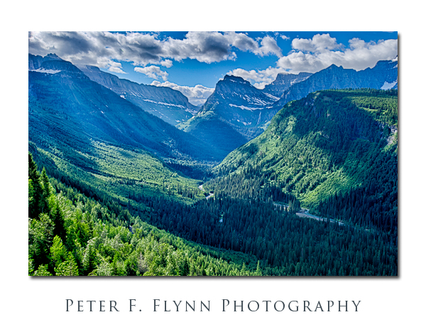
Looking towards higher ground from the Going-to-the-Sun Road.  HDR image recorded on July 23, 2011 at around 09:45, using the Nikon D3s and theAF-S NIKKOR 16-35mm f/4G ED VR lens at 35mm.  Exposure was f/11 with five source images bracketing +/- 2.o EV, +/- 1.0 EV, and 0.0 EV.

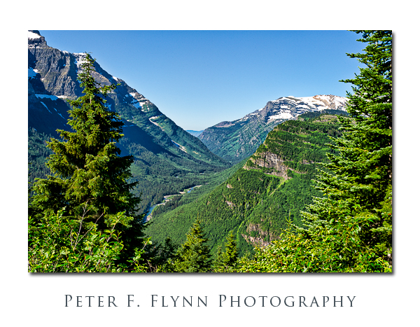
Looking eastward from the Going-to-the-Sun Road.  Image recorded on July 24, 2011 at around 10:00, using the Nikon D3s and the AF-S NIKKOR 24-70mm f/2.8G ED lens at 38mm.  Exposure was f/16 and 1/60s, ISO 200.

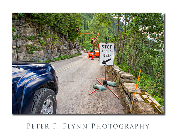
There was extensive construction along the upper sections of the Going-to-the Sun Road in the summer of 2011.  The automated signal rigs shown above were a common sight.  Image recorded on July 23, 2011 at around 10:30, using the Nikon D3s and the AF-S NIKKOR 24-70mm f/2.8G ED lens at 24mm.  Exposure was f/11 and 1/125s, ISO 800.  Handheld.

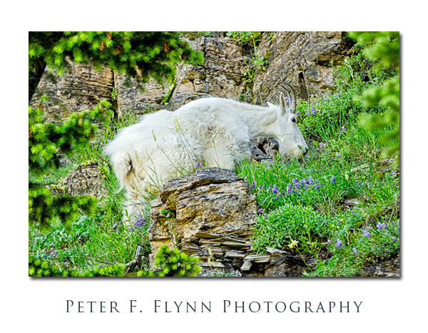
We found this billy goat just above the Going-to-the-Sun road at a spot below the Garden Wall where we had to pause for road construction.  Image recorded on July 24, 2011 at around 10:30, using the Nikon D7000 and the AF-S NIKKOR 200-400mm f/4G ED VR II lens at 400mm (600mm in FX).  Exposure was f/8 and 1/200s, ISO 1600.  Handheld.

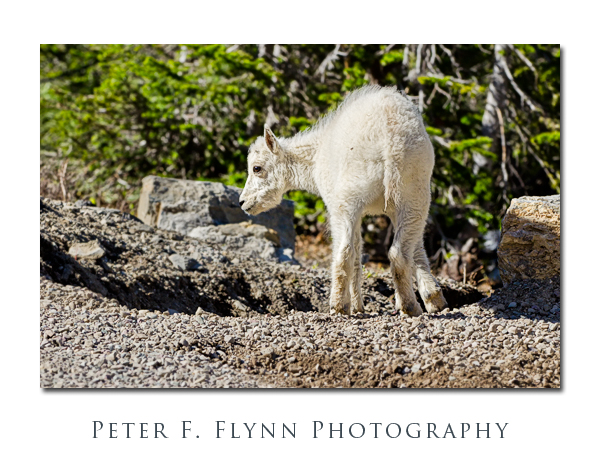
Mountain Goat calf near Logan Pass.  Image recorded on July 24, 2011 at around 17:30, using the Nikon D7000 and the AF-S NIKKOR 200-400mm f/4G ED VR II lens at 200mm (300mm in FX).  Exposure was f/9 and 1/1250s, ISO 800.  Handheld.

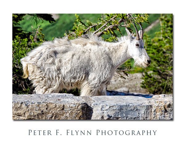
Nanny goat near Logan Pass.  Image recorded on July 24, 2011 at around 17:30, using the Nikon D7000 and the AF-S NIKKOR 200-400mm f/4G ED VR II lens at 200mm (300mm FX equivalent).  Exposure was f/9 and 1/1600s, ISO 800.  Handheld.

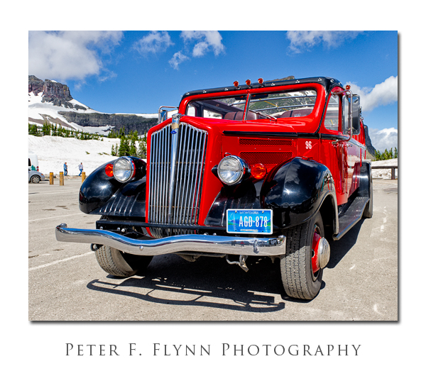
A Glacier Park Inc ‘Red Bus’ is shown parked at the Logan Pass Visitors Center.  These 1930’s vintage renovated convertible buses operate throughout the park.  Image recorded on July 23, 2011 at around 11:15, using the Nikon D3s and the AF-S NIKKOR 24-70mm f/2.8G ED lens at 28mm.  Exposure was f/11 and 1/640s (+1.0 EV), ISO 800.

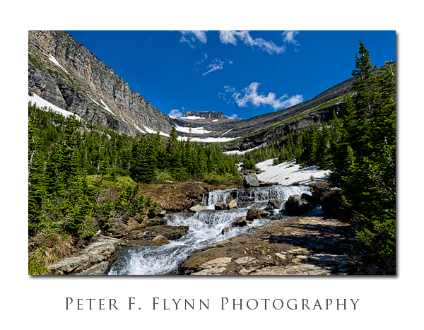
The view north from Going-to-the-Sun Road into Lunch Creek and Piegan Mountain.  Image recorded on July 23, 2011 at around 11:30, using the Nikon D3s and the AF-S NIKKOR 24-70mm f/2.8G ED lens at 24mm.  Exposure was f/16 and 1/125s (-0.67 EV), ISO 200.

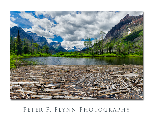
Near the north end of St. Mary Lake we encounter this log jam.  Image recorded on July 23, 2011 at around 13:15, using the Nikon D3s and the AF-S NIKKOR 24-70mm f/2.8G ED lens at 24mm.  Exposure was f/16 and 1/160s, ISO 800.


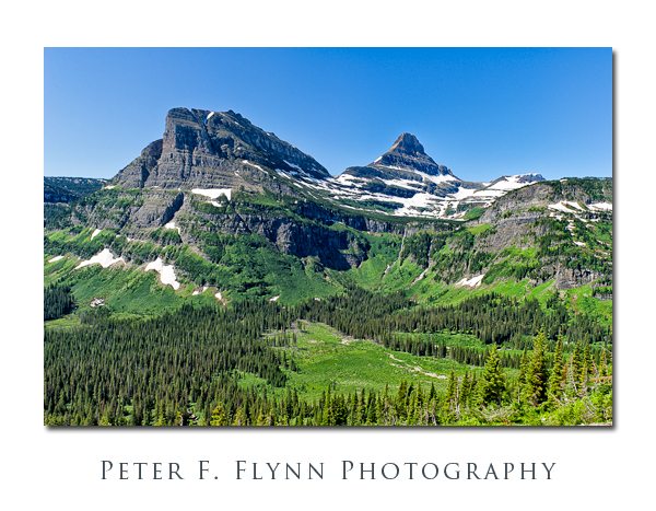
Heavy Runner Mountain (left) and Reynolds Mountain from the Going-to-the-Sun Road.  Image recorded on July 24, 2011 at around 11:00, using the Nikon D3s and the AF-S NIKKOR 24-70mm f/2.8G ED lens at 24mm.  Exposure was f/11 and 1/125s (+0.33 EV, normalized in ACR), ISO 200.

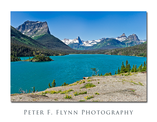
The view west from Sun Point on St. Mary Lake with  , from left to right, Citadel Mountain, Fusillade Mount, Reynolds Mountain, and Heavey Runner Mountain,  in the distance.  Image recorded at around noon on July 23, 2011, using the Nikon D3s and the AF-S NIKKOR 24-70mm f/2.8G ED lens at 36mm.  Exposure was f/16 and 1/3205s (+0.33 EV, normalized in ACR), ISO 800.

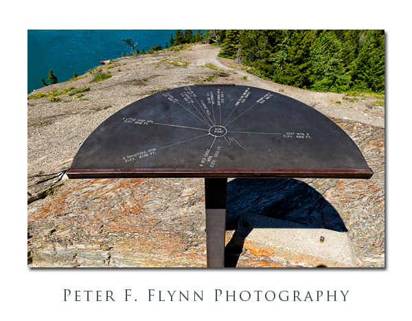
Steel sighting-map at Sun Point.  Image recorded on July 24, 2011 at around 11:00, using the Nikon D3s and the AF-S NIKKOR 24-70mm f/2.8G ED lens at 36mm.  Exposure was f/16 and 1/100s (+0.33 EV, normalized in ACR), ISO 200.

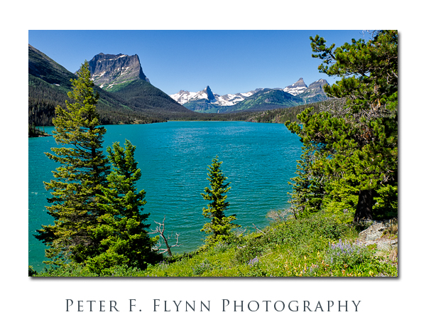
West bank of St. Mary Lake from the green side of Sun Point.  Image recorded at around noon on July 24, 2011, using the Nikon D3s and the AF-S NIKKOR 24-70mm f/2.8G ED lens at 36mm.  Exposure was f/11 and 1/500s, ISO 800.

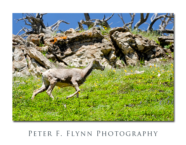
We found this bighorn sheep ewe along Swiftcurrent ridge near Lake Sherburne in the Many Glacier region of the park.  Image recorded on July 24, 2011 at around 14:00, using the Nikon D7000 and the AF-S NIKKOR 200-400mm f/4G ED VR II lens at 400mm (600mm in FX).  Exposure was f/8 and 1/200s, ISO 1000.  Handheld.

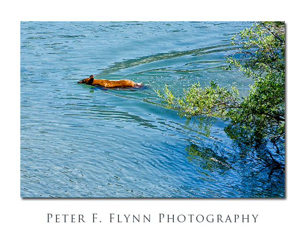
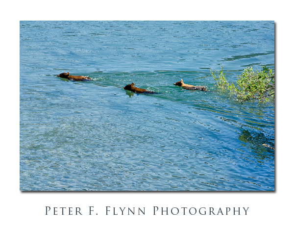
Finally, two images of a black bear sow (above) and her three cubs (below) navagating the shoreline of Lake Sherburne.  The foliage on the lake around Lake Sherburne is extremely mature in spots, and this bear family had to go amphibious to get around some significant obstacles.  The young bears seemed to have no fear of the water, and followed their mother without hestitation.  The color of the black bears in the Many Glacier area is remarkably variable, with many cinnamon-color animals.  Image recorded on July 24, 2011 at around 14:00, using the Nikon D7000 and the AF-S NIKKOR 200-400mm f/4G ED VR II lens at 400mm (600mm in FX).  Exposure was f/8 and 1/800s, ISO 800.

The images included in this picture-postcard summary represent only the briefest overview of the photographic possibilities present in Glacier.  The images were recorded on July 23 & 24, 2011, and are included in a more or less geographically organized fashion, in the way that you would encounter places along the Going-to-the-Sun road from west to east.

Copyright 2012 Peter F. Flynn.  No usage permitted without prior written consent. All rights reserved.
NE Entrance Road

The NE Entrance Road is one of the major thoroughfares of Yellowstone National Park, linking Tower Junction to the southwest and the northeastern park boundary.  From its western terminus at Tower Junction, the road heads northeast about 0.75 mile to the bridge over Yellowstone River.  The road turns to true east after the bridge.  The road then tracks along the Yellowstone and Lamar Rivers at the base of Specimen Ridge to the bridge at about 4.5 miles, and then another 0.6 miles to the junction with the road leading to Slough Creek Campground.  From the campground, traveling east another 0.75 mile brings you to the west end of Lamar Canyon.  The length of the canyon is about 1 mile, and opens at the east end to the broad expanse of the Lamar Valley.  The road then heads southeast along the Lamar River for 2.75 miles to the Yellowstone Associate Camp, and then another 2.8 miles to the confluence of the Lamar River and Soda Butte Creek.  The confluence of the Lamar River and Soda Butte Creek is a major park reference point, and both rangers and park cognoscenti refer to the location as ‘The Confluence’.  From here to the park boundary the road runs alongside Soda Butte Creek.

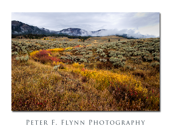
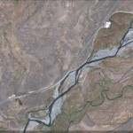
Assuming that you are coming from points west, and after passing through the Lamar Valley, it is just when you think you have left Yellowstone’s geothermal features behind that you run nearly right in Soda Butte at 2.3 miles east of The Confluence.  This extinct cone is just a few feet south of the road.  This is where we associate the story with images.  The image above was shot at a turnout about a half mile southwest of Soda Butte (1.8 miles east of The Confluence).  There is a minor stream here that drains the high ground to the north into Soda Butte Creek.  The relatively abundant water supports the growth of Chokecherry and other leafy plants, generating a stark contrast again the pale green of the sage.  The image was recorded at 11:30 MDT on October 16, 2011, using the Nikon D3s and the AF-S NIKKOR 16-35mm f/4G ED VR at 23mm.  Exposure was f/11 at 1/25s, ISO 200, +0.33 EV.  A dark and mostly rainy day.  The image was processed using Photoshop CS5 with Nik Viveza 2 and Color Efex Pro 4 plugins.  Capture and output sharpening was applied using Photokit Sharpener 2.

A Google Earth image of the location appears below:

Traveling northeast along the road brings you, after 3.3 miles, to the Pepple Creek Campground, the last camping spot along the road. After traveling another 1 mile you will arrive at the Thunderer trail head (3K3) parking lot and the entrance to Soda Butte Canyon.  Soda Butte Canyon is tucked in between the Barronette Peak to the northwest and The Thunderer massif to the southeast.  The road continues through Soda Butte Canyon, coming after about 1.5 miles to the narrow Icebox Canyon.  There is a very nice picnic spot just at the northern end of Icebox Canyon – we saw a small Griz on the far side of the stream here in the early spring of 2011.  The road continues through Soda Butte Canyon reaching the WY state line at about 5.8 miles further, and the park station at about 2 miles beyond the state line crossing.

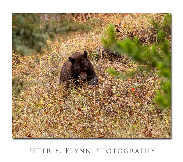
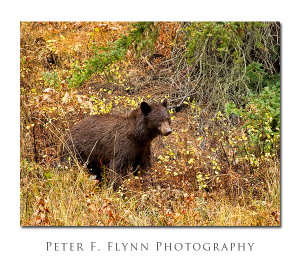
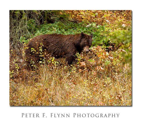
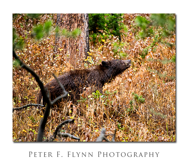
This region of the park is home to many animals, including both Black Bear and Griz, but because of the relative steepness of the canyon walls on either side, the wildlife is only visible when they are basically right along the road.  This situation presents a minor hazard, since it is possible to encounter Griz with relatively little advanced warning.  If you stop along the road here, I strongly advise you to keep your bear spray close at hand.  On this visit was were fortunate to catch a glimpse of a Black Bear foraging along the north side of the road.  The location was approx 100 meters northeast of the turnout for the Thunderer Trail.  We were able to watch this bear for about 30 minutes before it wandered off into the dense forest. I have come to notice that Black Bear rarely look directly at me, and perhaps even avoid direct eye contact.  Many species consider eyes-on to be a threatening gesture, and I suspect that Black Bear are quite adept at avoiding conflict.  This behavior is quite distinct from that of Griz, which will tend to keep a steely bead on you at all times.

Images of the Black Bear were recorded at around 17:30 MDT on October 16, 2011, using the Nikon D3s and the AF-S NIKKOR 200-400mm f/4G ED VR II at 400mm.  Exposure was f/4.0 and 1/125s to 1/200s, ISO 6400.  Yeah, here as in many posts, these images are possible because the D3s + VR exist.  The noise is actually pretty modest, but the color noise components were reduced using Nik Dfine.  Additional processing was applied using Nik Viveza 2 and Color Efex Pro 4 and Photokit Sharpener 2 plugins.

Copyright 2011 Peter F. Flynn.  No usage permitted without prior written consent. All rights reserved.
GTNP 137 and Her Cubs

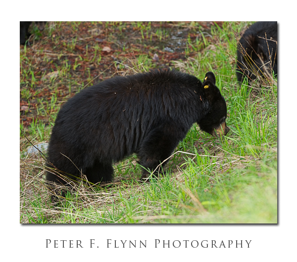
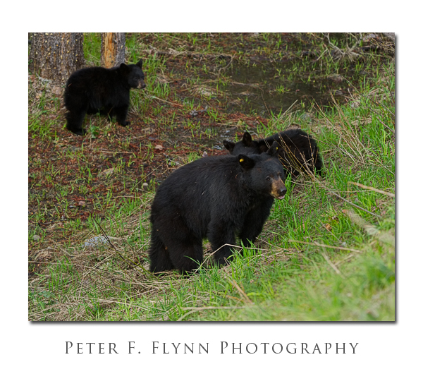
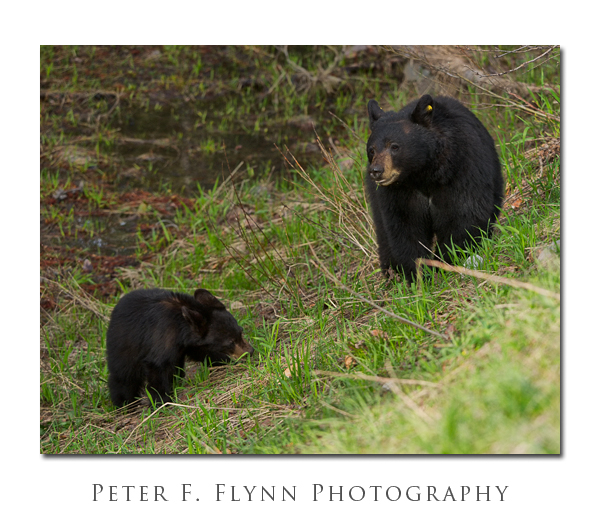
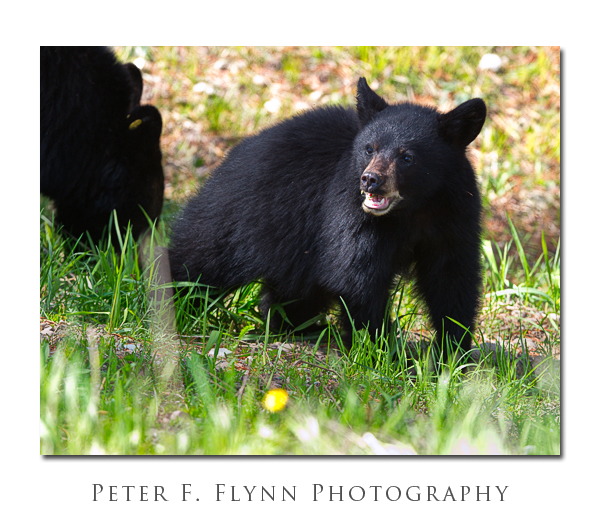
GTNP 137 is a Black Bear, Ursus americanus, living in the heavily forested part of the vast central area of Grand Teton National Park (GTNP) that lies between Jenny Lake to the west, and the Bridger-Teton National Forest to the East.  GTNP 137 is the tag this sow Black Bear wears on its right ear.  The tag on the left ear ends in 38, but I cannot get a clear view of any other letters/numbers, if there are any.

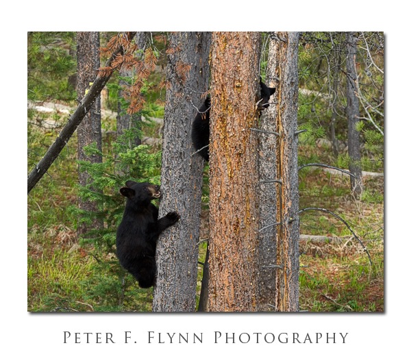
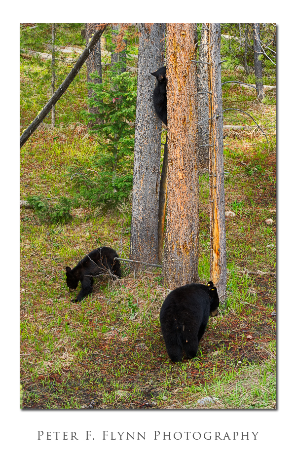
With this sow are two healthy yearling cubs.  Black Bear cubs only need to stay in the general vicinity of their mother, since when threatened they exhibit the most extraordinary defensive climbing skills.  Black Bear cubs seem to literally fly up trees, stopping at ~15 feet to evaluate danger before climbing higher or descending.  This behavior is quite distinct from that of Grizzly Bear cubs, which tumble along close behind their mother as they travel across relatively open meadows and plains.

Park biologists estimate that there are between 100 and 150 Black Bear in GTNP.  Since Black Bears favor densely forested areas pretty much exclusively, it is uncommon to see these animals whilst traveling along the Jackson Hole Highway, but we were at the right place at the right time (near Deadman’s Bar Road).  We work hard at getting lucky.

Seeing Black Bear, or just about any animal for that matter, takes a fair bit of determination.  Ask rangers for advice about where animals have recently been seen – and by that I mean, ask *all* the rangers you run into, since information about animal sightings tends to move slowly within the ranger network.  The folks that work at the main entrances tend to be a little out of the loop.  People you find at one animal sighting tend to be amongst the best sources of information – just ask what they’ve seen, where, when, etc – folks are generally very enthusiastic about sharing information.  Even if the information is a few hours old, it can be very valuable, since certain species, e.g., Bear and Moose, tend to hang around a particular site for several hours or even days.

Images in this entry were recorded between 08:00 and 09:00 on June 4, 2011, using the Nikon D3s, and the AF-S VR Zoom-NIKKOR 200-400mm f/4G IF-ED at mostly 400mm.  Exposures were at f5.6 and 1/800s, ISO 2500.  Image processing was accomplished using Photoshop CS5 with Nik and PhotoKit Sharpener plugins.

Copyright 2011 Peter F. Flynn. No usage permitted without prior written consent.  All rights reserved.