July 20, 2009
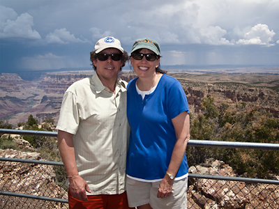
It has been about 20 years since the HP and I visited the south rim of the Grand Canyon, and so we decided it might be a good idea to drive around and see how things were coming along. The route from the north rim to the south rim takes you north back to Jacob Lake, then eastward along Highway 89A (Alt 89) to the junction between 89 and 89 A near Bitter Springs. The route then continues south along 89 to the junction of 89 and Highway 64, which runs back westward into the park. In total the journey is about 210 miles, and can be done easily in about four hours. We arrived at the park entrance at around noon to find a large and complex matrix of clouds forming to the east-southeast of the park.
The first stop for most visitors coming from the east along Highway 64 will be Desert View. Here, you’ll find the Watchtower – a faux Indian structure/gift shop – and your first encounter with The Horde. Fortunately, although it is a shock to meet so many people in such a small place, it’s about as dense as it gets on the south rim. It is possible to drive to the eastern points all year long, including Navajo Point, Lipan Point, the Tusayan Ruin (started raining for the first time that day), and Moran Point. All of the points along the rim are worth a stop – if even for a couple of minutes.
The closer one travels to Grand Canyon Village (map), the more dense the vehicle travel becomes, and at Grandview Point we found ourselves as part of about 20 cars circling the lot looking for a parking spot. Due to ongoing construction around the Canyon View Visitors Center, I advise that you do not attempt to drive to Mather Point – it’s just way too crazy. Instead, our experience was that it was easier to dodge the traffic and turn south at the junction of Desert View Drive (the rim road) and the South Entrance Road. Continue along the South Entrance Road until you reach Center Road (the signage is pretty good). Turn right onto Center Road west-bound to Market Plaza, or, since we were staying there, the Maswik Lodge Parking lot (it’s only about 100 meters from the Maswik Lodge to the Rim Trail).
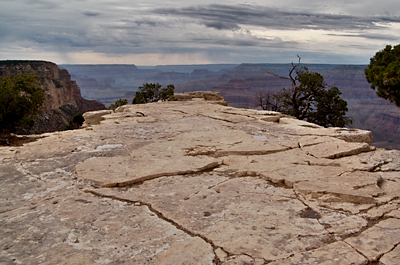
The west end of the Rim Trail near the Bright Angel trail head and the Kolb Studio (closed for renovation until Aug 1, 2009) is an excellent point to begin your exploration of the south rim. The slope is uphill walking eastward, which may seem daunting at first, but remember that you gotta walk home… I’d suggest that you stroll at least at far as Verkamps (Curios) Visitor’s Center – if you are keen and energetical, the walk to the Yavapai Observation Station is awesome. A few hundred meters west of the Observation Station you will encounter Grandeur Point – this provides an excellent complementary view to the one you’ll have at the Station, however it might not be suitable if you are leading a group of unrestrained children or have a thing about unprotected view points.
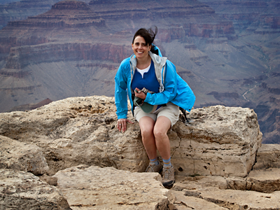
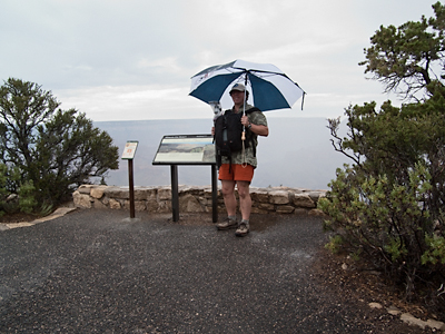
And here’s a snap of the HP way out on the end of the Point – yep, it’s very windy out there…
On our way back to Maswik Lodge, we detoured south along the Mather Amphitheater and the Shrine of the Ages into Market Plaza and the excellent grocery store. Here, you will find just about anything you might need in the way of food, or in our case, cold beerz. We caught a Blue Route (*) bus westward back to Maswik Lodge – easily one of the most crowded bus rides I’ve ever been on…anywhere. Anyway, it was a short ride.
July 21, 2009
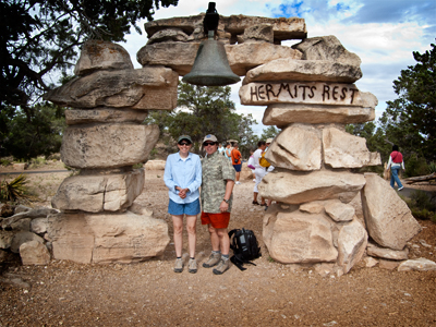
We caught an early Red Route shuttle bus west towards Hermit’s Rest. You need to start out early to avoid a long line at the shuttle station – by 9am, you can plan to wait for two or three buses to arrive and depart before you catch a ride. The shuttle bus is the only manner in which able-bodied people can travel west of Grand Canyon Village at this time of the season. The shuttle bus visits every point on the westward route, but makes limited stops on the return trip (Pima Point, Mohave Point, and Powell Point). We got off at Pima Point and shot a few pics before getting on a bus headed for Hermit’s Rest. Hermit’s Rest is a kooky end-of-the-road sort of affair. There’s a snack bar, gift shop, restroom, and ranger’s dorms. It’s beautiful of course, but – in my view – is less naturally photogenic than are some of the other locations along the south rim.
We then rode the bus eastward to Mohave Point. Three major rapids of the Colorado River are visible from Mohave Point: Hermit, Granite, and Salt Creek. After several days of afternoon showers, the Colorado has turned from blue-green to muddy brown. We continued on foot eastward along the rim trail, stopping at Hopi Point, Powell Point, Maricopa Point, and the Trailview Overlook. The remains of the Lost Orphan Mine dominate Maricopa Point (see below) – or perhaps more accurately, current clean up efforts dominate. The Lost Orphan Mine was active- first as a copper mine and then later as a uranium mine (!!!) from 1893 until the 1960’s. Most of the Bright Angel trail is visible from the Trailview Overlook – with an almost mechanical procession of hikers and mule teams wandering up and down the canyon trail.
After lunch we rode a Blue Route bus eastward to the Canyon View Information Plaza – I’m not a fan of this name at all – too industrial sort of thing. Furthermore, the visitors center is built to grand scale, but somehow lacks the energy you expect in this sort of place. By now it was windy and raining pretty heavily – time to wait it out in the bookstore – which is pretty good actually.
As soon as the rain began to lessen a bit we embarked on our scouting mission by hopping on a Green Route bus to Yaki Point. It was still raining by the time we arrived at Yaki Point (about 4pm MST), but it was clear that this was where we wanted to be at sunset. The HP has the awesome idea to stay out of the rain by riding the Green Route bus from Yaki Point to Pipe Creek Vista, on to the visitor’s center, the South Kaibab Trailhead (there’s a mule corral here), and then back to Yaki Point. We got off of the bus long enough to confirm that this was the spot where we wanted to setup for the sunset shot.
We caught the next bus for the visitor’s center and a walk to Mather Point. The place is a human zoo. You got every race-color-creed, from newborn to ancient, crowded into the point. Mather Point itself is one of the largest overlooks on the south rim, only it doesn’t feel that way for the crush of people. My challenge to you when you visit is to try to make a shot without another person in the shot – I’d even let you go with a vertical! We headed west along the rim trail towards the Yavapai Observation Station (approaching from the east this time) and can confirm that this section of the Rim Trail hosts as many folks as anyplace along the south rim. We returned to the visitor’s center and caught a ride to Yaki Point. Our first thought was that we there way too early – about 18:00 MST – but the steady stream of folks departing the subsequently arriving buses confirmed that we had accidentally arrived exactly on time (yeah, about 2.5 hours before sunset). We spent the next couple of hours sharing the space – about 2 meters square – with two friendly gents from back east (North Carolina and New Jersey if I recall correctly).
We stalk good sometimes. The rain abated. The light at sunset was excellent and haze was not too terrible – guess all that rain helped clear out some of the normal levels of dust. All in all, a most pleasant visit to the south rim of the Grand Canyon.
The images in this entry were all recorded using the Nikon P6000. The shots of the kiva at the Yavasupai Ruin, Grandeur Point, and the last one at Yaki Point were taken by the HP – pretty good!
FYI, the bus routes have each been given two names. The Red Route is also known as Hermit’s Rest Route; the Blue Route is alo known as the Village Route; and the Green Route is also called the Kaibab Trail Route.
