Archive for the ‘Wildlife Photography’ Category

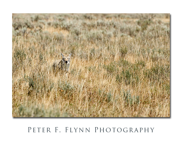
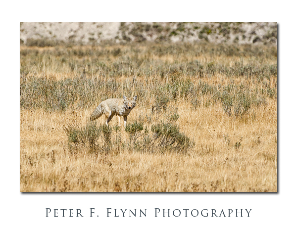
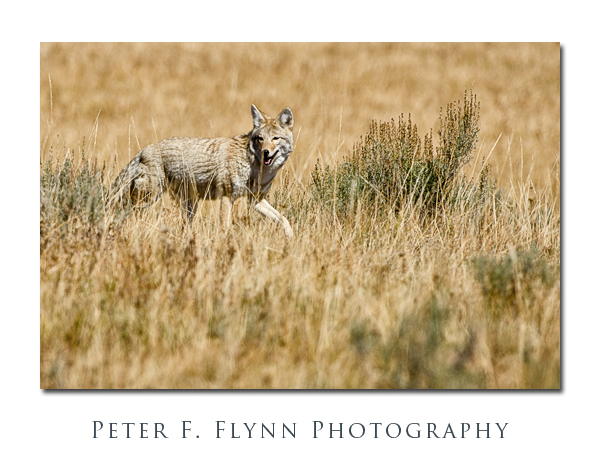
A Trickster in Hayden Valley

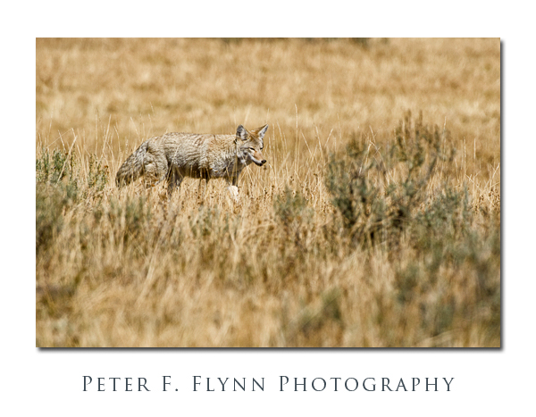
A number of native American Indian cultures have identified the coyote as The Trickster.  A trickster is a sort of cunning character who makes use of subterfuge, i.e., illusion, misdirection, etc., usually with the goal of committing some sort of fraud.  Accepting for the sake of discussion that it is valid to anthropomorphize wild animals, then to my eye, the suggestion that the coyote is a trickster is an apt judgement – they always seem to be up to something slightly sketchy.

This trickster nature is apparent in the way the coyote carries itself, which a bit shifty, moving through the sagebrush or tall grass like a pickpocket working the crowds at a carnival.  The short, persistent gait of the coyote is distinct from that of the wolf, which has longer legs and a resulting much more open stride. Parenthetically, although there are several ways to distinguish wolf and coyote, the difference in gait is the thing that I notice first.

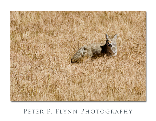
And of course that Coyote face, which is so full of mischief…  Is it my imagination, or are these guys always squinting?

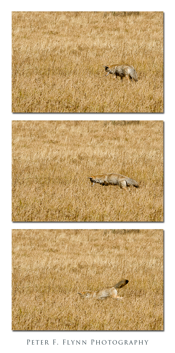
Perhaps it is their opportunistical feeding behavior that impresses me most.  Unlike wolves that hunt large prey in organized hierarchical groups, the coyote bounces around solo or in pairs, and will eat anything it can.  Voles seem to be a staple food of the coyote.  We have watched coyotes consume half a dozen voles in a single episode – in fact I cannot recall seeing coyotes eat anything but voles!

Leaving out the anthropomorphic judgements, there is no doubt but that the coyote is a highly adaptable and highly successful creature.  The Trickster even adapts relatively well to urbanization.  Although it is most common to observe coyotes hunting solo or in pairs, within Yellowstone, coyotes live in packs of up to seven individuals.

Prior to the reintroduction of wolves into Yellowstone in 1995, the coyote population grew to relatively large numbers due to the lack of a major predator.  In the years immediately following restoration of a stable wolf population, coyote numbers fell 30-50%, but the population has now stabilized.  The Yellowstone Resource and Issue 2011 report* does not provide a specific population esitmate for coyotes, and lists the population only as ‘numerous but unknown’.

Images in this entry were recorded in the Hayden Valley, Yellowstone National Park, at around 13:30 MDT on September 21, 2011, using the Nikon D7000 and the AF-S NIKKOR 200-400mm f/4G ED VR II  at 400mm (600 mm FX equivalent).  Exposures were made at f/5.6, f/7.0, and f/8.0 with shutters speeds at either 1/1000s or 1/1250s.  Tripod setup was the Gizto GT5541LS and the Wimberly WH-200 gimbel head.

*The Yellowstone Resource and Issues 2011 report is issued annually, and is produced by the Division of Intepretation, Yellowstone National Park, Mammoth Hot Springs, WY.  The report is available at the park bookstores and online at the followstone site:

http://www.nps.gov/yell/planyourvisit/resourceandissues.htm

Copyright 2011 Peter F. Flynn.  No usage permitted without prior written consent. All rights reserved.
NE Entrance Road

The NE Entrance Road is one of the major thoroughfares of Yellowstone National Park, linking Tower Junction to the southwest and the northeastern park boundary.  From its western terminus at Tower Junction, the road heads northeast about 0.75 mile to the bridge over Yellowstone River.  The road turns to true east after the bridge.  The road then tracks along the Yellowstone and Lamar Rivers at the base of Specimen Ridge to the bridge at about 4.5 miles, and then another 0.6 miles to the junction with the road leading to Slough Creek Campground.  From the campground, traveling east another 0.75 mile brings you to the west end of Lamar Canyon.  The length of the canyon is about 1 mile, and opens at the east end to the broad expanse of the Lamar Valley.  The road then heads southeast along the Lamar River for 2.75 miles to the Yellowstone Associate Camp, and then another 2.8 miles to the confluence of the Lamar River and Soda Butte Creek.  The confluence of the Lamar River and Soda Butte Creek is a major park reference point, and both rangers and park cognoscenti refer to the location as ‘The Confluence’.  From here to the park boundary the road runs alongside Soda Butte Creek.

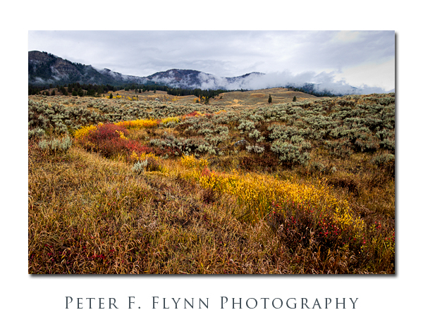
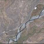
Assuming that you are coming from points west, and after passing through the Lamar Valley, it is just when you think you have left Yellowstone’s geothermal features behind that you run nearly right in Soda Butte at 2.3 miles east of The Confluence.  This extinct cone is just a few feet south of the road.  This is where we associate the story with images.  The image above was shot at a turnout about a half mile southwest of Soda Butte (1.8 miles east of The Confluence).  There is a minor stream here that drains the high ground to the north into Soda Butte Creek.  The relatively abundant water supports the growth of Chokecherry and other leafy plants, generating a stark contrast again the pale green of the sage.  The image was recorded at 11:30 MDT on October 16, 2011, using the Nikon D3s and the AF-S NIKKOR 16-35mm f/4G ED VR at 23mm.  Exposure was f/11 at 1/25s, ISO 200, +0.33 EV.  A dark and mostly rainy day.  The image was processed using Photoshop CS5 with Nik Viveza 2 and Color Efex Pro 4 plugins.  Capture and output sharpening was applied using Photokit Sharpener 2.

A Google Earth image of the location appears below:

Traveling northeast along the road brings you, after 3.3 miles, to the Pepple Creek Campground, the last camping spot along the road. After traveling another 1 mile you will arrive at the Thunderer trail head (3K3) parking lot and the entrance to Soda Butte Canyon.  Soda Butte Canyon is tucked in between the Barronette Peak to the northwest and The Thunderer massif to the southeast.  The road continues through Soda Butte Canyon, coming after about 1.5 miles to the narrow Icebox Canyon.  There is a very nice picnic spot just at the northern end of Icebox Canyon – we saw a small Griz on the far side of the stream here in the early spring of 2011.  The road continues through Soda Butte Canyon reaching the WY state line at about 5.8 miles further, and the park station at about 2 miles beyond the state line crossing.

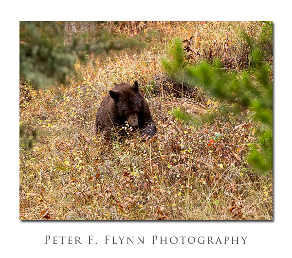
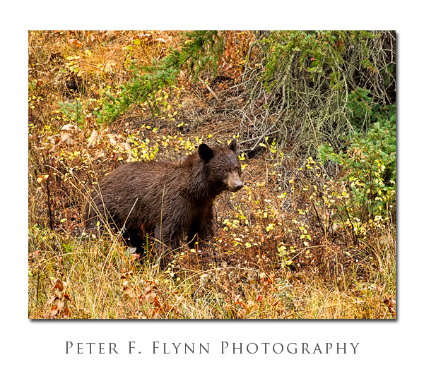
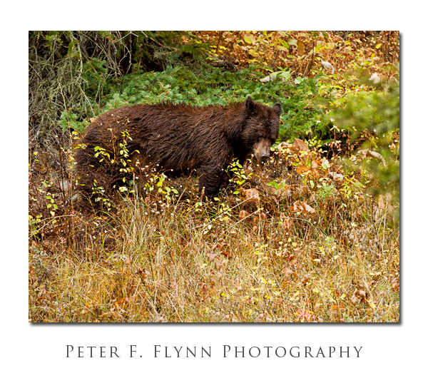
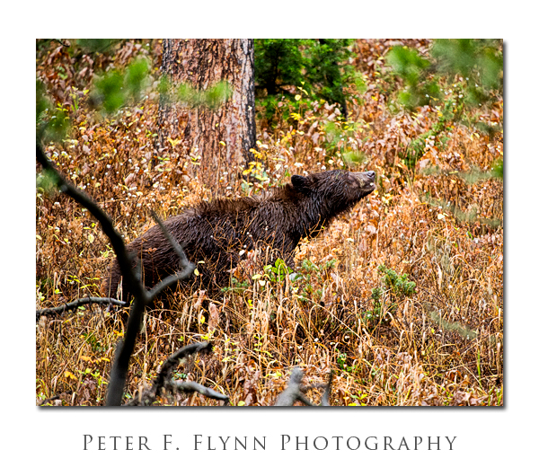
This region of the park is home to many animals, including both Black Bear and Griz, but because of the relative steepness of the canyon walls on either side, the wildlife is only visible when they are basically right along the road.  This situation presents a minor hazard, since it is possible to encounter Griz with relatively little advanced warning.  If you stop along the road here, I strongly advise you to keep your bear spray close at hand.  On this visit was were fortunate to catch a glimpse of a Black Bear foraging along the north side of the road.  The location was approx 100 meters northeast of the turnout for the Thunderer Trail.  We were able to watch this bear for about 30 minutes before it wandered off into the dense forest. I have come to notice that Black Bear rarely look directly at me, and perhaps even avoid direct eye contact.  Many species consider eyes-on to be a threatening gesture, and I suspect that Black Bear are quite adept at avoiding conflict.  This behavior is quite distinct from that of Griz, which will tend to keep a steely bead on you at all times.

Images of the Black Bear were recorded at around 17:30 MDT on October 16, 2011, using the Nikon D3s and the AF-S NIKKOR 200-400mm f/4G ED VR II at 400mm.  Exposure was f/4.0 and 1/125s to 1/200s, ISO 6400.  Yeah, here as in many posts, these images are possible because the D3s + VR exist.  The noise is actually pretty modest, but the color noise components were reduced using Nik Dfine.  Additional processing was applied using Nik Viveza 2 and Color Efex Pro 4 and Photokit Sharpener 2 plugins.

Copyright 2011 Peter F. Flynn.  No usage permitted without prior written consent. All rights reserved.
Bighorn Sheep in Gardner Canyon

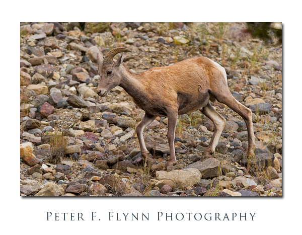
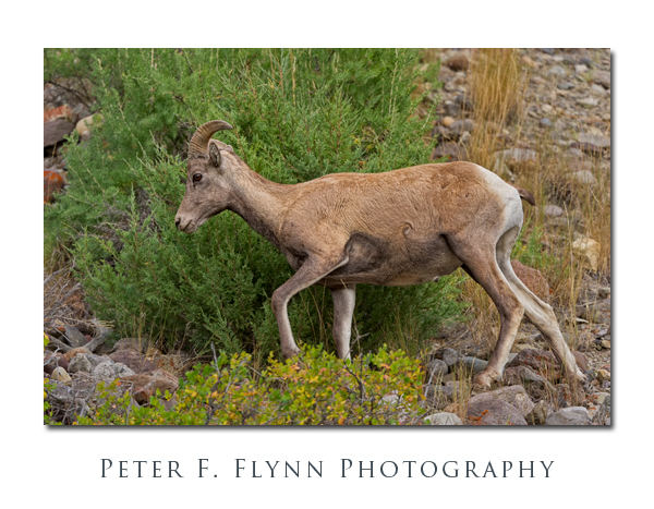
Ask any YNP Park Service employee about Bighorns.  ‘Go to Gardiner’, will be their response, or perhaps ‘Go to Gardner’, but it’s the same.  Regardless, that advice is not quite definitive.  They  may mean to refer to the city on the banks of the Yellowstone River, or they may mean the river that meets the Yellowstone just north of the park entrance, or they may mean the area between the confluence and Yankee Jim Canyon…

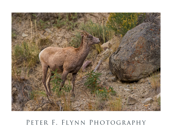
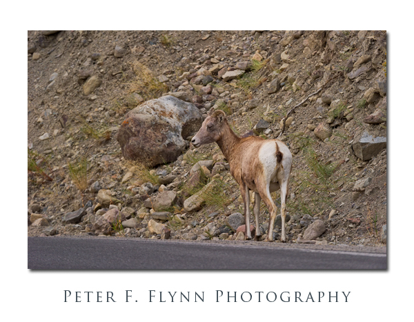
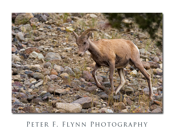
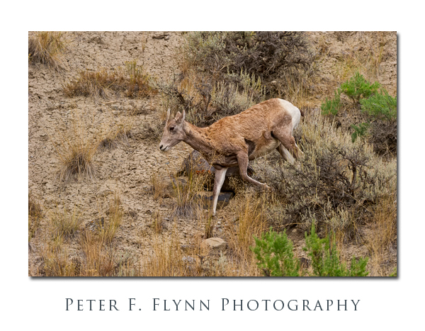
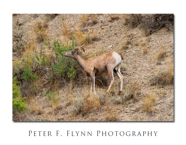
You are in fact most likely to find Bighorns in Gardner Canyon, although they appear semi-randomly, that is, unpredictably but always in weak light. In our experience, we find that the herds that wander close to the North Entrance Road below the McMinn Bench and Eagle Nest Rock consist mostly of mature ewes and young sheep of both sexes.

If you are so lucky as to be in the Canyon when the Bighorns are there, I suggest that you shoot them at f/5.6, since you’ll need the isolation.  These clever sheep…they are almost invisible in their native environment – the little teasers…  When they do emerge, ‘excess’ DOF is not a positive contribution, since it helps them hide, well, in the image that is…

Images in this entry were recorded at around 17:00 MDT using the Nikon D3s and the AF-S NIKKOR 200-400mm f/4G ED VR II.  Exposures were all at f/5.6 and around 1/640s, ISO 3200.  Yeah, that was ISO 3200.  If you are serious about stalking the Bighorns, bring your D3s, seriously.

Images were processed to reduce noise using Nik Dfine, then capture sharpening was applied using Photokit Sharpener 2.0.  The image was then processed to enhance contrast using Nik Viveza 2 and Nik Color Efex Pro 3.

 Copyright 2011 Peter F. Flynn.  No usage permitted without prior written consent. All rights reserved.