Archive for the ‘National Parks and Monuments’ Category

Just Don’t Call Me “Chipmunk”

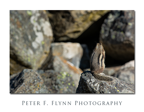
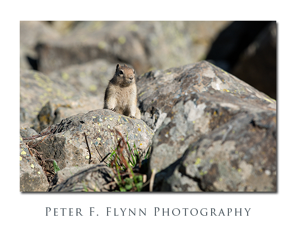
Golden-Mantled Ground Squirrel at Sheepeater Cliff

There are three kinds of proper chipmunks that are commonly found up in The Stone:  The Least Chipmunk, The Uinta Chipmunk, and the Yellow-Pine Chipmunk.  How would you like to be named ‘least’?  It is true that the Least Chipmunk is the smallest chipmunk in North American, still, being called ‘least’ is kinda having ‘stinky’ for a nickname…

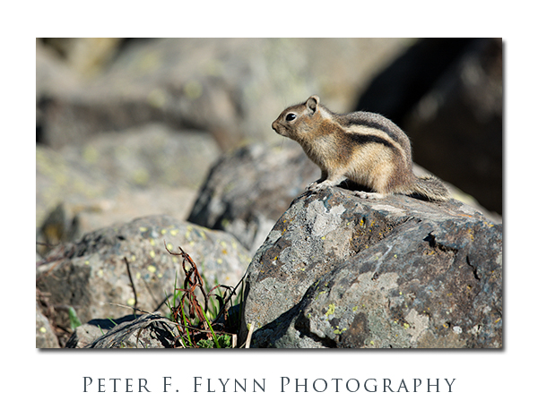
Golden-Mantled Ground Squirrel at Sheepeater Cliff

The cute little dude shown above is neither, in fact not a chipmunk at all.  In spite of the chipmunk-like stripes on its back, this critter is a Yellow-Mantled Ground Squirrel (YMGS).  The definitive ID is made by the absence of stripes on the head and face and the lack of pointy little ears.  Also, although you could  not tell from the image,  the YMGS is quite a big larger than its chipmunk cousins.

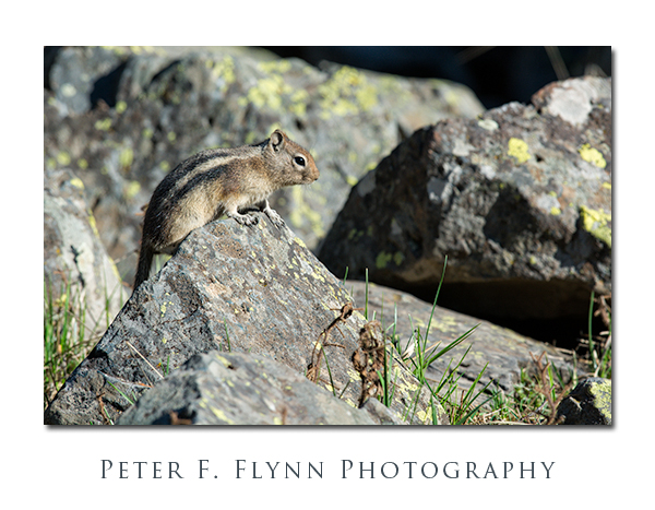
Golden-Mantled Ground Squirrel at Sheepeater Cliff

Squirrel and chipmunk behavior is actually very distinct.  I have a hell of a time shooting chipmunks – their movement is unpredictably twitchy and they are easily spooked.  Squirrels by contrast are inveterate beggars, and will fearlessly scurry right up to you in hope of getting a treat.

Golden-Mantled Ground Squirrel at Sheepeater Cliff

Images in this entry were recorded at 08:30 MDT on May 15, 2013, using the Nikon D7100 and the AF-S NIKKOR 600mm f/4G ED VR lens.  Exposure was f/8.0 and 1/640s, ISO 400.

 Copyright 2013 Peter F. Flynn.  No usage permitted without prior written consent. All rights reserved.


Encounter at 2K8 (Hellroaring Trailhead)

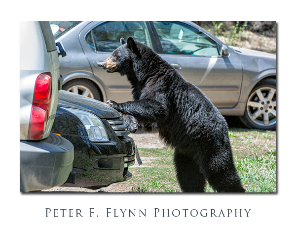
PFF_D7100_20130515_0540_v2_Framed

I’m not much for novelty photography.  Let’s say that there is a bear dancing the ‘Macarena’ in the middle of the Yellowstone picnic area – I’d wait for the bear to stop dancing before beginning to shoot – okay, perhaps that’s a bit of an exag, but I’d run shots only if the bear was dancing real good…

The story behind the image above begins, as so many of the posts on this site does, with the HP.  The HP has two major roles – she is 1st and foremost, the transporter-extraordinare, getting us into position for the shoot – her less-well-known but equally important role is as chief intelligence officer.  Yeah, without intelligence you will be lost in the vastness of The Stone.  Right, I did mention Hellroaring…that’s in The Stone (as in Yellow-Stone, git with it people!).  Anyway, winning is about knowing where you need to go, and getting there before the plebes arrive, invariably screwing things up so that the NPS has to close the show down.

It’s around noon on May 15, 2013, and we are near the outlet of the Blacktail Plateau Drive, at the end of a bear-viewing event.  I see the HP hanging with Mr. Ranger-Sir and some folks with things to share.  The HP is in intelligence-gathering mode – looks kinda like a cat stalking prey…  She gets a tidbit, turns, and heads for the truck – time to go boys!  Nearly leaves one of us in the dust, damn this must be good.  Hellroaring, black bear, cub.  Dood, we’ve visited Hellroaring dozens of times and not seen a damned thing…  No point in arguing, the HP is set on course, we are off for Hellroaring.
PFF_D7100_20130515_0534_v2_Framed

Arriving at the 2K8 parking lot, we scramble gear together and head down the path.  Wait, okay, back up…some (most) of you have no idea what I’m talking about.  First, let me clarify that every trail in The Stone has an official designation – trailheads are distinct from paths.  The designator 2K8 is specific for the trailhead for a number of trails leading into the Yellowstone River and Hellroaring Creek basin.  These paths include, 2H1, 2H2, 2H3, 2H4, 2H5, 2H6, 2H7, 2H8, 2H9, 2C1, 2C2, 2C4, 2R1, 2R2.  The 2K8 also provides access to the backcountry trailheads 2N1 amd 2N5, which are located north along the Gallatin NF/Stone boundary.  The key point is that 2K8 is directly in the middle of the action.
PFF_D7100_201305415_0537_Framed

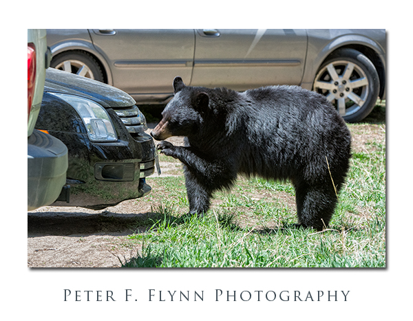
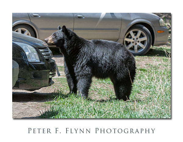
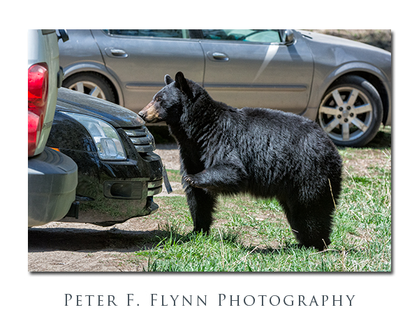
We march out along the trail headed east and pretty-much run squaw into a black bear sow with a yearling cub.  The cub is instantly up a tree and momma bear is keenly intent on keeping us at a distance.  In standard black bear behavior, this sow wanders slowly up the trail, backing everyone up into the parking lot.  Once in the parking area, the sow decides that a vehicle inspection is the order of the day.
PFF_D7100_20130515_0539_Framed

In the end I think it’s bugs.  Dead bugs.  On the license plate.  Illinois plate, plenty of bugs.  I guess the idea is that given plenty of dead bugs on the plates, there must be more on the hood.  In the end, the sow fended off the infidel-humans.  The humans got their photo-op.  Rangers and plebes alike had no idea about what happened here – kinda like Vegas actually, what happened here, stayed here…

Some of you may be wondering what the Macarena is…  Substitute Charleston, Bossa Nova, Mashed Potato, Tejas 2-Step, Worm, Cha Cha Slide, Crank That Soulja Boy, Single Ladies, Dougie, etc., depending on your age.

All images in this entry were recorded on May 15, 2013, at around 12:00, using the Nikon D7100 and the AF-S NIKKOR 200-400mm f/4G ED VR II.  Exposure was f/8.0 and 1/640s, ISO 2000.

Copyright 2013 Peter F. Flynn.  No usage permitted without prior written consent. All rights reserved.
Panos of the DEVA

No, not that Deva…  Not the God, actually Gods, of Hindu mythology.  I mean DEVA, as in the four-letter Alpha Code (*) the National Park uses as an abbreviation of the full park name, Death Valley National Park.

Please select the thumbnail to see the full pano…

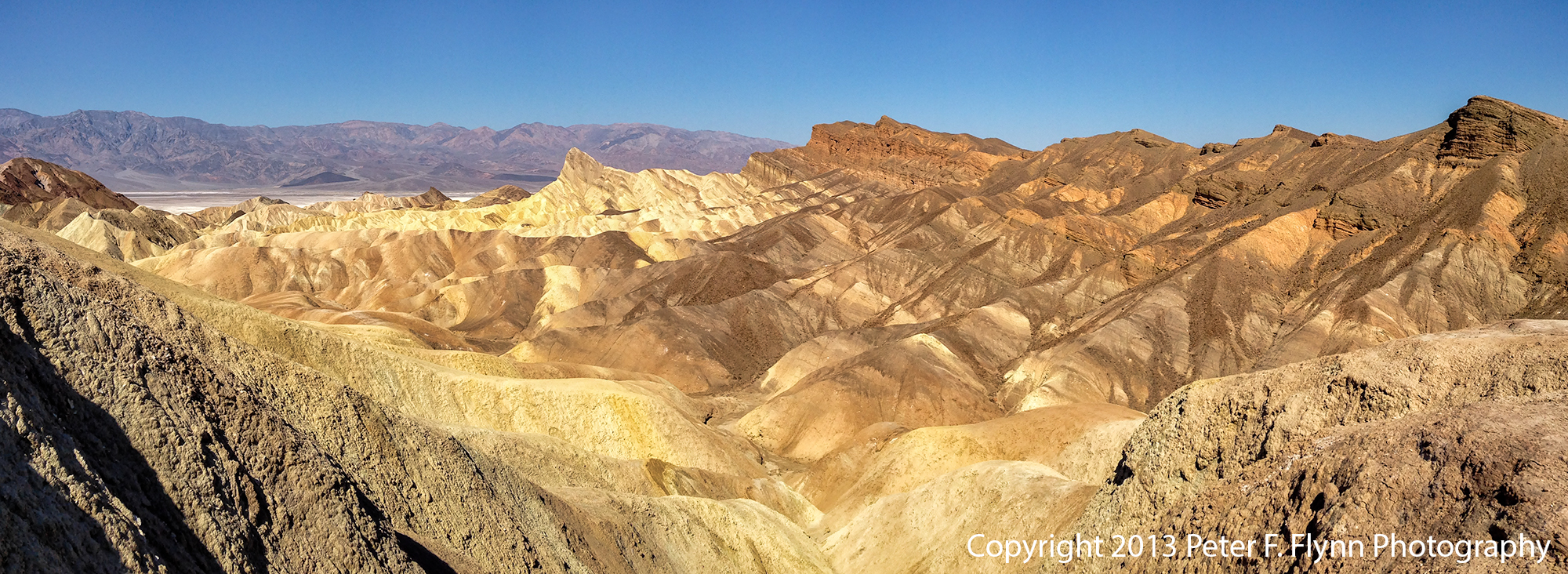
Death Valley National Park

The pano above, of the HP at Dante’s Point, was recorded on March 24 at  9:00 PDT, using the iPhone5 (iP5).   Exposure was f/2.4 and 1/2500s, ISO 50.  I’m still getting used to these iP5 exposure stats…  Note that while this is not the best composition, it includes the HP, which is more than enough to recommend it as an excellent pano!

Death Valley National Park

The pano above of the Zabriske Point experience was recorded at 10:30 PST using the iP5.  Exposure was f/2.4 and 1/3400s, ISO 50.

Death Valley National Park

Right, so we began the day at Dante’s View, then back down Dante’s View Road to Furnace Creek Road, and further on to CA SR-190.  Then along SR-190 north past Zabriske Point, and then Furnace Creek.  Staying on 190, we headed west past Stovepipe Wells, then across the salt pan to Emigrant, and then Panamint Springs, finally stopping at Father Crowley Point/Vista.

The view from Father Crowley’s Vista, shown above, is definitely one of the best views in the park – it is relatively peaceful here, far from the madding crowd.  Images recorded at 13:00 PST.  This image is pas tout à fait prêt à porter – I’ll work it on luminance and contrast and repost ASAP…

Death Valley National Park

Father Crowley Vista was as far east as we traveled on this visit.  We then returned back along SR-190.  The image above, recorded at around 14:00 PST, was shot looking east from the east side of Panamint Springs.

Mesquite Flats Sand Dunes, Death Valley National Park

On the morning of March 25, we traveled from out hotel in Furnace Creek to Stovepipe Wells to shoot the Mesquite Flat Sand Dunes at sunrise.  The weather did not cooperate, and the sun was behind a heavy shield of clouds, but I managed to shoot the pano above.  Image recorded at 8:00 PST.

Devil's Golf Course, Death Valley National Park

Having been disappointed at Stovepipe, we headed back south towards Badwater.  Along the way we stopped at the Devil’s Golf Course, shown above.  Image recorded at 10:13 PDT.  The intermittently cloudy sky gave us a bit of drama in this shot.

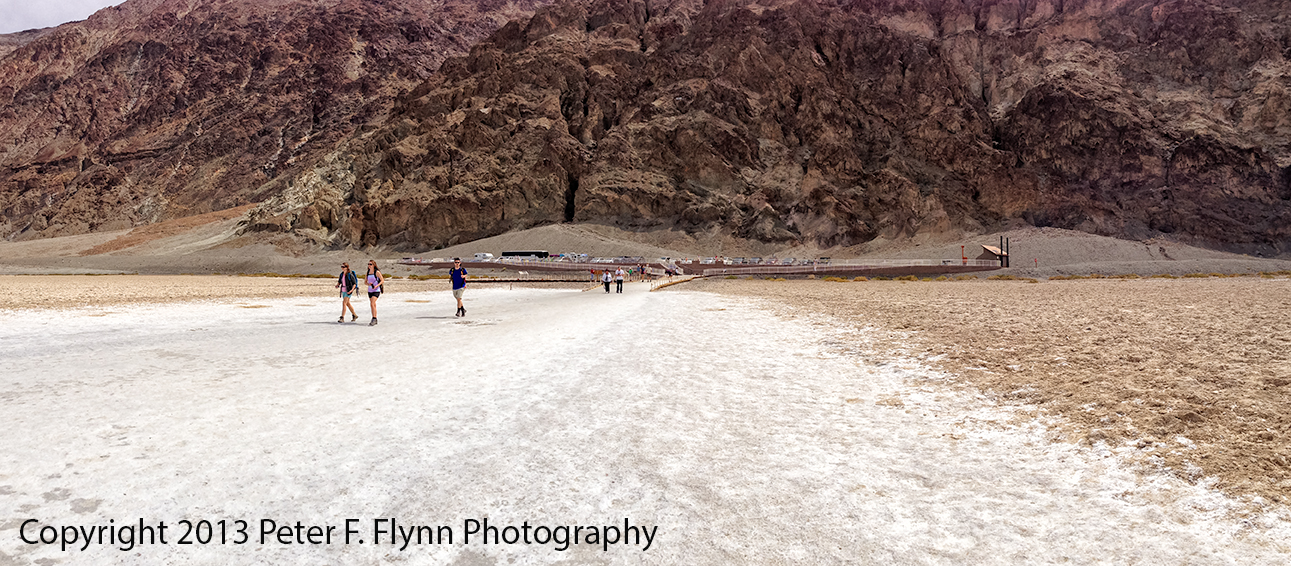
Badwater Salt Flats, Death Valley National Park

Continuing south along the Badwater Road, we reached Badwater Basin at around noon, see above and below.

Badwater Salt Flats, Death Valley National Park

(*) Alpha Codes for parks that have a single title name, like Yellowstone, are generated using the first four letters, e.g., YELL.  For parks with names consisting of two or more words, like Death Valley, the code is generated using the first two letters of the first two words in the name, e.g., DE + VA = DEVA.  BTW, unlike the Deva of Hinduism, which is generally benevolent, DEVA, as we have seen in this entry, is a hostile place for man and beast alike.  On the other hand, using YELL for something as cool as Yellowstone is a bit lame – we should use a tough name like STONE, as in ‘Yeah, I just got back from a week up in the STONE…’  Right, as usual, another discursive blog entry!

Feliz 5 de mayo!

Copyright 2013 Peter F. Flynn.  No usage permitted without prior written consent. All rights reserved.