Archive for the ‘National Parks and Monuments’ Category

Glass Mountain

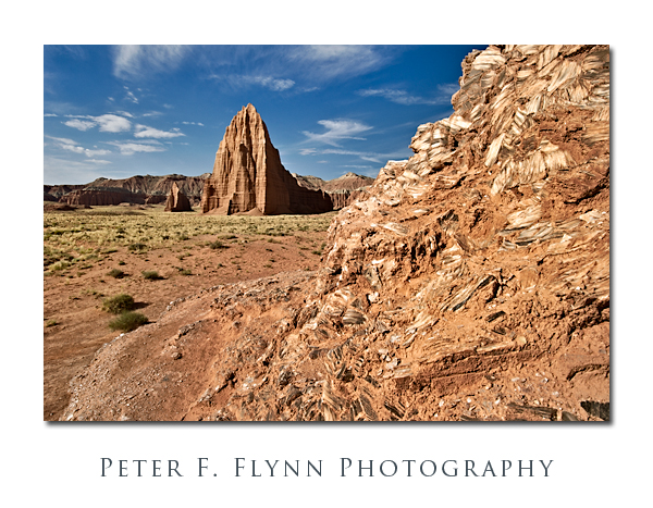
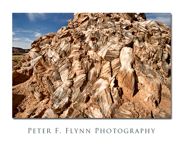
It’s not really made of glass, of course, but if you are traveling in the Cathedral Valley of Capitol Reef National Park, the exposed mound of selenite crystals (gysum) is definitely worth a stop.

Glass Mountain is located about 0.5 miles north of the Temple of the Sun along a road that splits off from the path that leads to the Temples.  The Mountain is a jumble of large crystals that rise about 20 feet from the valley floor.  There is a fair amount of clay covering the crystals, and as shown below, there is likewise a significant amount of inclusions within the milky white crystals themselves.

Images of Glass Mountain were recorded at around 09:15  on July 23, 2010, using the Nikon D3s and  AF-S NIKKOR 16-35mm f/4.0G VR ED at the 20mmk (first image) or 16mm (2nd image).  Exposure was f/16.0 and 1/250s or 1/400s, ISO 400.

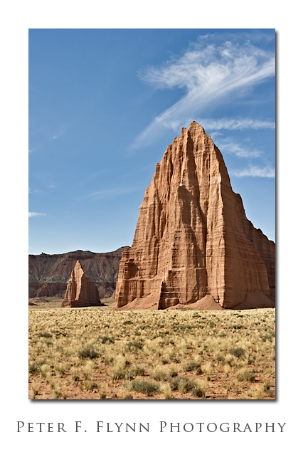
In addition to the obvious setup with Glass Mountain in the foreground and the Temple of the Sun and the Temple of the Moon in the background, this spot is also an excellent location from which to make a medium telephone shot of the Temples alone as shown below.

The image of the Temples of the Sun and Moon was recorded using the AF-S NIKKOR 24-70mm f/2.8G ED lens at 52mm.  Exposure was f/16.0 and 1/80s, ISO 200.

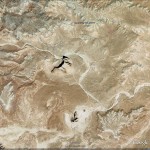
GPS coordinates of the site are 38° 27.2863′ N, 111° 11.5066′ W.  A Google-Earth image of the site is shown below:

Copyright 2010 Peter F. Flynn. No usage permitted without prior written consent. All rights reserved.
Temple of the Sun, Temple of the Moon

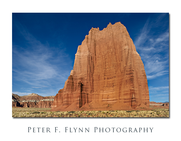
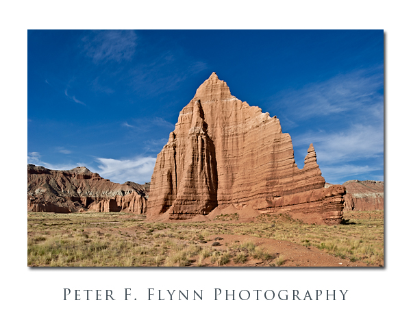
The Temple of the Sun and The Temple of the Moon are found near to one another in the most beautiful and remarkable Cathedral Valley District of Capitol Reef National Park.  The area is most easily reached from the Cainville Wash Road (about 18.5 miles east of the Visitor Center), which may be accessed by traveling east from nearby Torrey, the Park Campground, or points in the vicinity along Highway 24.  Although these natural cathedrals can be reached by traveling the commonly suggested route from the (Fremont) River Ford Crossing, e.g., clockwise around the Loop Road, if you will want to visit them during morning light (as you certainly should), then you must approach from Caineville.

The Temples are the first in a series of remarkable sights that await visitors traveling the anti-clockwise direction on the Cathedral Valley Road (mostly northeasterly).  They are within a quarter mile of one another at approximately 17.5 miles from the entry point at the Caineville Wash.

The images above of the Temple of the Sun and the Temple of the Moon were recorded at around 08:00 on July 23, 2010, using the Nikon D3s and the PC-E NIKKOR 24mm f/3.5D ED.  Both images made shooting almost exactly into the west, since the morning sunlight shines directly onto the rock surfaces – beauty!  Exposure was f/16 and 1/60s (+0.67 EV), ISO at 200.  For rendering images of monoliths like the Temples, there is simply no substitute for the PC-E lens.  The shift controls are efficient and the lens is among the sharpest in the Nikon (or any) inventory.  The lens is manual focus, but the camera will indicate when you are on focus, so it is a minor compromise – negligible actually.  Easily one of my favorite lenses.

The Temples are composed of Entrada Sandstone formed from materials deposited during the Jurassic Period, approx 175 Ma +/- 30 Ma.  This is the same dark red layer that is prominently exposed in Arches National Park, Capitol Reef National Park (obviously, but throughout the park), and also prominently in Goblin Valley State Park.  The complete USGS specification for the deposit is ‘Entrada Sandstone of the San Rafael Group‘ and the type style is located at Entrada Point.  The big question then, is why only a few monoliths survive to tower over the valley floor.  The answer is that local fractures dominate the erosion pattern and that the valley as we see it now is the result of the random faulting and subsequent erosion of the Entrada Sandstone layer over the eons.

GPS coordinates for the site (closer to the Sun) are 38,27.0992N/111,11.4461W.  Read that 38 degrees, 27.0992 minutes north latitude; 111 degrees, 11.4461 minutes west longitude.

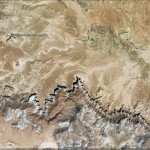
A Google Earth image of the area encompassing the Temple of the Sun and the Temple of the Moon appears below:


Copyright 2010 Peter F. Flynn. No usage permitted without prior written consent. All rights reserved.
Fruita Schoolhouse

Capitol Reef National Park.  Although it is the equal of any of the scenic wonders of the Grand Staircase, it is generally far less crowded than Zion or Bryce Canyon.  This is due to the simple fact that it lies a little further on down the road, and is therefore left off many a family’s itinerary.  The area is not recorded on official maps before 1872, and the road from Richfield to nearby Torrey was not paved until 1940.

In spite of its remote location, by 1880 Mormon settlers had established a farming and ranching outpost that would eventually acquire the name Fruita.  An apt name, for fruit orchards planted by the Mormon pioneers are still thriving here.  Capitol Reef was established in 1937 as a National Monument (NP in 1971), and by the late 1960s the Park Service had acquired most of the privately held property.

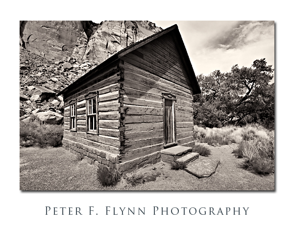
One of the more interesting remaining pioneer buildings is the one-room Fruita Schoohouse shown above.  The structure is listed on the National Registry of Historic Places, and the specific entry may be found here.

The image of the schoolhouse was recorded at about 16:00 MDT on July 22, 2010, using the Nikon D3s and the AF-S NIKKOR 16-35mm f/4G ED VR lens at 16mm.  Exposure was f/16 and 1/320, ISO 800.  Image converted to BW using Nik Silver Efex.

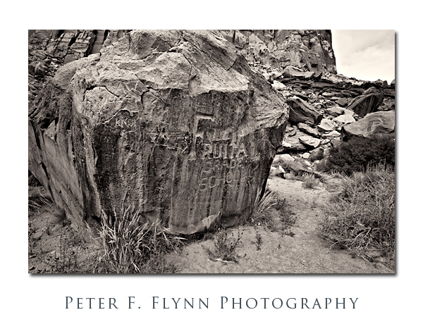
The boulder inscribed with the name of the location lies just behind the schoolhouse (north).  In addition to the engraved ‘Fruita Grade School’, there are a plethora of other minor inscriptions.  Same exposure and processing parameters as for the schoolhouse image.

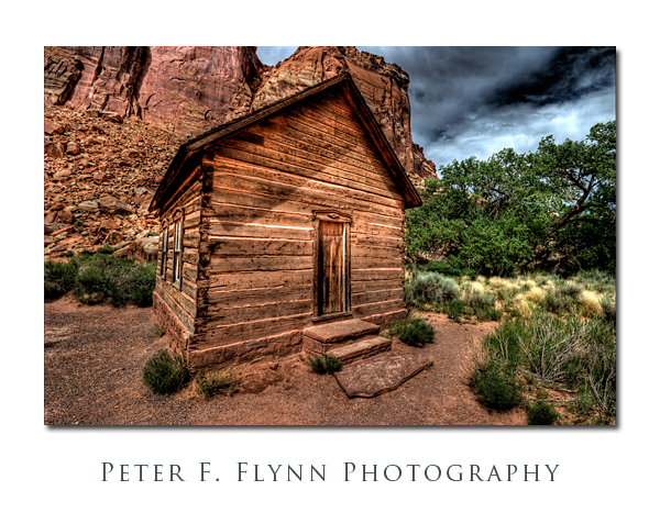
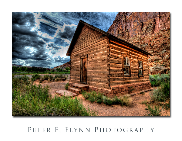
Images like the schoolhouse have become prime candidates for what has become known as one-shot HDR processing.  Using this method, single RAW files are converted into HDR images as shown below.  Images converted to HDR using Photomatix Pro 3.

The results are almost always processed using Details Enhancer mode (in Photomatix parlance) to produce a characteristically illustrated or ‘painterly’ representation of the image.  I don’t know.  Although I reject all impressionistic representations on the basis of principle, that is not really the issue here.  There is something simultaneously intriguing and unsettling about this representation.  Frankly, it is certainly more compelling than the BW representation in many instances.  Anyway, if you like this sort of thing, I invite you to enjoy the effort.  At any rate, I cannot resist the opportunity of exploring new methods, so you’ll see more of this stuff.

Copyright 2010 Peter F. Flynn. No usage permitted without prior written consent. All rights reserved.