Archive for the ‘Adventure’ Category

Crossing the Madison River

The Madison River is born at the confluence of the Gibbon and Firehole Rivers near the Madison Junction in Yellowstone National Park.  From Madison Junction, the Madison flows westward to the park boundary, and then northwesterly into the Madison Valley at the Wyoming/Montana state boundary.  The River widens and becomes shallow near the West Entrance, allowing wildlife to cross relatively easily.

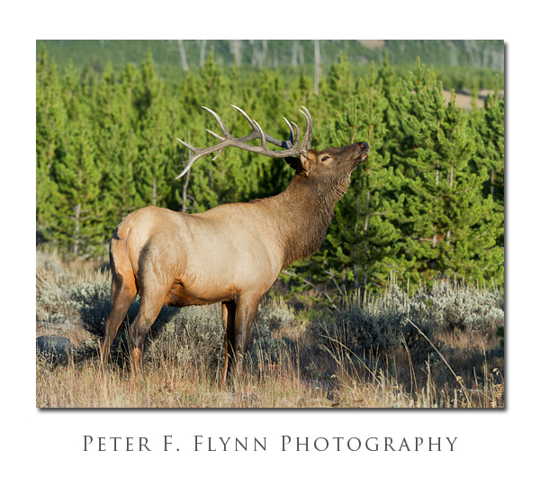
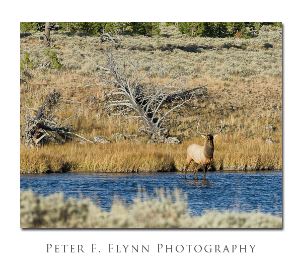
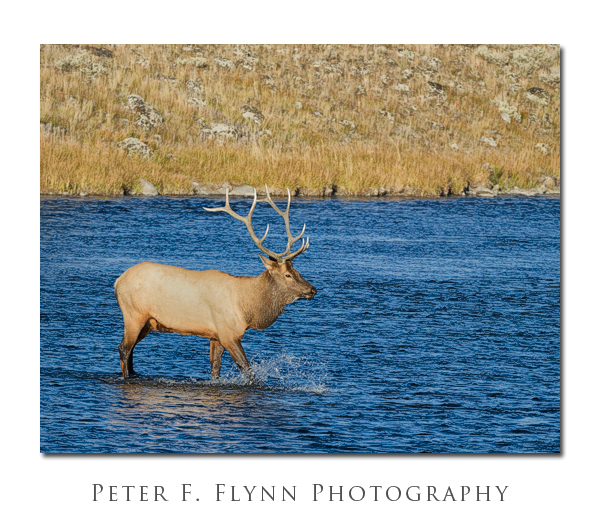
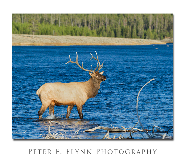
In our experience, the most effective way to observe wildlife in Yellowstone NP is to keep moving.  Others may have equally good strategies, but this traveling thing seems to work pretty well.  On a late afternoon excursion to the West Entrance, we happened upon this magnificent bull Elk strolling across the Madison River at a point somewhere between the most western of the picnic areas and the West Entrance gate.

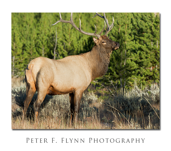
By the time the Elk had crossed the Madison River, there were dozens of cars lining the roadway watching.  For its part, the big bull maintained his dignity and level best to ignore the imposing Human.  The final images, above and below, show the spirit of this awesome creature, proud and strong in the failing autumn light.

Images in this entry were recorded on September 20, 2010, at around 18:30 MDT, using the Nikon D3s and the AF-S VR Zoom-NIKKOR 200-400mm f/4G IF-ED lens at 400mm.  Exposures were all at f/8 with shutter speeds around 1/1600s (+0.33 EV), ISO at 1250.

Images were processed using a combination of Photoshop and 2nd-Vendor utilities, including Photokit Sharpener, and the Nik Suite.  Viveza 2 was used to adjust brightness/contrast/local-contrast.  Color Efex Pro 3 was used to employ adjustable vignetting to emphasize the central subject.

Copyright 2011 Peter F. Flynn. No usage permitted without prior written consent. All rights reserved.
 

Strike Valley Overlook

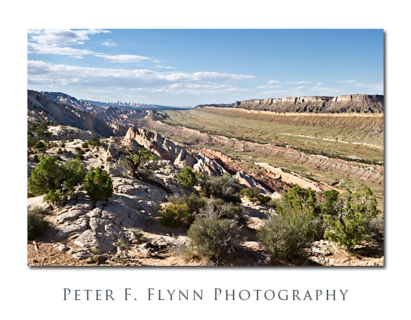
One of the highlights to a visit to Capitol Reef National Park is a drive south along the Notom-Bullfrog Road (NBR).  The NBR heads south-southeast from the junction with Utah Highway 24 (about 9 miles east of the Visitors Center), and slips along the margin between the Waterpocket Fold and Strike Valley.  At about 34 miles from the junction of the NBR and UT24, you reach a junction that heads westward up the Burr Trail Switchbacks.  A short drive west from top of the switchbacks brings you to the Upper Muley Twist Road that heads north along the Waterpocket Fold.  From the end of the road a short hike eastward brings you to a world-class perch, the famous Strike Valley Overlook – seriously, I’ve walked all over the west, this may be THE place.

To be precise, a ‘strike valley’ is a common geological formation found most anywhere immediately adjacent to a significant fold or upheaval.  What we are talking about in this entry however is among the best examples found anywhere.  This strike valley runs along the southern portion of the Fold from Cedar Mesa Camp about 11 miles south of UT 24 to the southern margin of the Park.  The overlook grants views of the Strike Valley north and south along the Waterpocket Fold, and east to the Henry Mountains.

The image above was recorded at 18:00 MDT on July 24, 2010, using the Nikon D3s and the NIKKOR AF-S 24-70mm f/2.8G ED lens at 42mm.  Exposure was f/16 and 1/200s (+0.33EV), ISO 400.  Coordinates of the site are 37,52.9900N/111.2.5372W.

The overlook may also be reached from the west, by traveling east 26 miles out of Boulder, UT.  The Burr Trail Road is paved from Boulder to about 5 miles before the switchbacks.  On this visit we executed a loop trip back along this route to Boulder, and then north to Torrey, UT, along the magic UT Highway 12.

A few important suggestions.  It would be an excellent idea to stop by the Visitors Center and chat with the staff about road conditions.  Be aware that Park Staff are programmed to speak from a ‘better safe than sorry’ perspective, however this truly is a remote region with no water, and challenging driving conditions.  The NBR is paved for the first 5 miles south from the junction with UT24, and then converts into dusty washboard south of that point.  As is true most everywhere in south-central UT, roads in wet to very wet conditions are impassable, as in if you attempt to move you will slide off of the road, or become stuck in thick mud.  The Burr Trail switchbacks are steep, but perfectly safe in dry conditions – they might be a bit of  thrill for those with little backcountry driving experience.  The Upper Muley Twist Road cannot be safely navigated by a low-clearance vehicles, although 4WD is probably only necessary in wet conditions.  I also predict that very large pickups and wide vehicles (think Hummers) will have to execute some tricky moves to make it to road’s end (we drove a Toyota Tacoma with the crew-cab and associated short-bed).

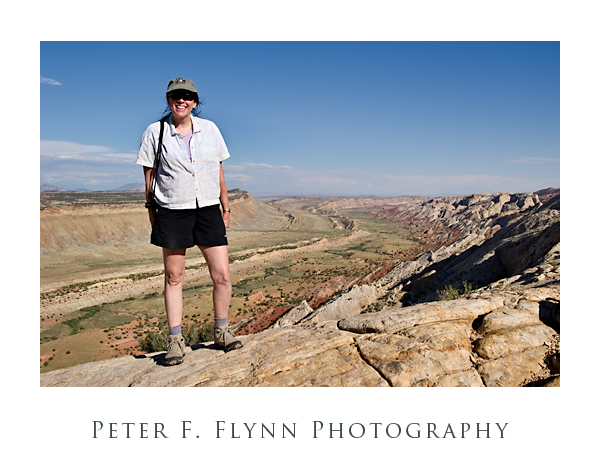
Finally (below), a shot of The HP, and the southern view into the Strike Valley.  The image was recorded using the D3s and the 24-70mm lens at 32mm.  Exposure was f/16 and 1/400s, ISO at 400.  Handheld.  You could not deduce it from her calm and relaxed appearance in the image, but the HP was the most awesome support ever – carrying a 20lb camera bag and tripod while chasing a panicky photog back and forth along a 200 meter section of the Fold in the failing light.

Copyright 2010 Peter F. Flynn. No usage permitted without prior written consent. All rights reserved.
Glass Mountain

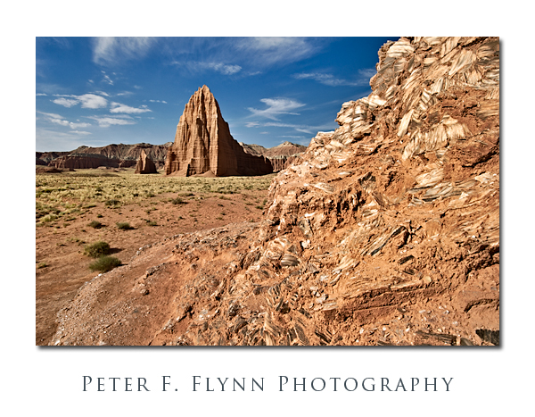
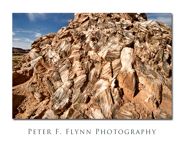
It’s not really made of glass, of course, but if you are traveling in the Cathedral Valley of Capitol Reef National Park, the exposed mound of selenite crystals (gysum) is definitely worth a stop.

Glass Mountain is located about 0.5 miles north of the Temple of the Sun along a road that splits off from the path that leads to the Temples.  The Mountain is a jumble of large crystals that rise about 20 feet from the valley floor.  There is a fair amount of clay covering the crystals, and as shown below, there is likewise a significant amount of inclusions within the milky white crystals themselves.

Images of Glass Mountain were recorded at around 09:15  on July 23, 2010, using the Nikon D3s and  AF-S NIKKOR 16-35mm f/4.0G VR ED at the 20mmk (first image) or 16mm (2nd image).  Exposure was f/16.0 and 1/250s or 1/400s, ISO 400.

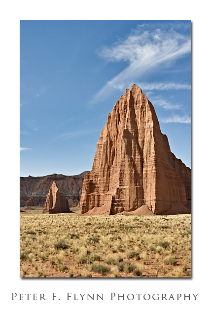
In addition to the obvious setup with Glass Mountain in the foreground and the Temple of the Sun and the Temple of the Moon in the background, this spot is also an excellent location from which to make a medium telephone shot of the Temples alone as shown below.

The image of the Temples of the Sun and Moon was recorded using the AF-S NIKKOR 24-70mm f/2.8G ED lens at 52mm.  Exposure was f/16.0 and 1/80s, ISO 200.

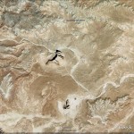
GPS coordinates of the site are 38° 27.2863′ N, 111° 11.5066′ W.  A Google-Earth image of the site is shown below:

Copyright 2010 Peter F. Flynn. No usage permitted without prior written consent. All rights reserved.