If you are fortunate enough to book lodging at the Old Faithful Inn, I suggest that you can optimize the photographical potential of the adventure by dividing your day(s) into two parts. Reserve the mornings and early afternoons for hikes on the trails and boardwalks around the Upper, Midway, and/or Lower Geyser Basin areas, and plan to visit the Madison River in the late afternoon. In this post I’ll review our visit to the Upper Geyser Basin, including the area near Old Faithful and Black Sand Basin, north to Morning Glory Pool.
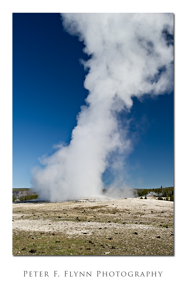
The image above, of an eruption of the Old Faithful Geyser, was recorded at about 09:00 MDT on May 16, 2010, using the D3s, and the AF-S NIKKOR 16-35mm f/4G ED VR at 35mm. Exposure was f/11 at 1/125s, ISO 200.
Upper Geyser Basin is an area of about 5 square miles that includes a number of geyser groups including, from south to north, the Myriad Group, Black Sand Basin, the Geyser Hill Group, Grand Group, Giant Group, Daisy Group, Morning Glory Group, and Biscuit Basin. Biscuit Basin was closed in the spring of 2010 for an extensive renovation of the boardwalk system.
Whether or not you are staying near Old Faithful, starting a visit at the geyser is advisable since it gives you the opportunity to stop by the visitor’s center. In the spring of 2010, the visitor’s center was housed in temporary quarters just south of Old Faithful. The visitor’s centers charts the eruption patterns for a number of geysers, so it’s an essential stop if you are keen to maximize your geyser viewing (which you should, obviously).
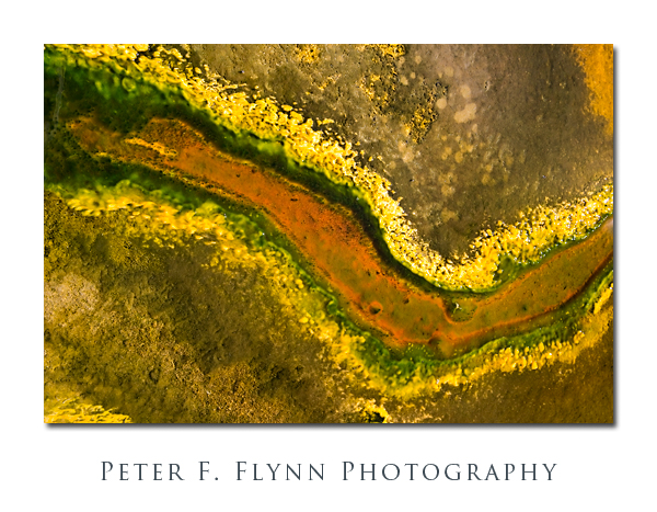
The image above demonstrates that even in the relatively hostile environment of the Upper Geyser Basin, life will always find a way. The image of algae, a bacterial mat, and varicolored mud, was recorded at about 09:45 MDT, on May 16, 2010, using the Nikon D3s, and F-S NIKKOR 24-70mm f/2.8G ED at 35mm. Exposure was f/8 at 1/500s, ISO 200. Handheld.
After starting the morning watching Old Faithful spout off, we strolled through the adjacent Geyser Hill Group that includes several small but worthy geysers and pools. We continued as far north as Grand Geyser, where we witnessed its impressive eruption before looping back past Castle Geyser to the visitor’s center. While waiting in line to check up on an eruption cycle, a ranger announced the eminent eruption of Beehive Geyser (a relatively unpredictable geyser) – and we dashed off. The eruption of Beehive Geyser is most remarkable, being higher, of greater duration, and more forceful than Old Faithful (no still images do this event justice). We decided to explore the northern section of the the Upper Geyser Basin via a trail leading from Black Sand Basin.
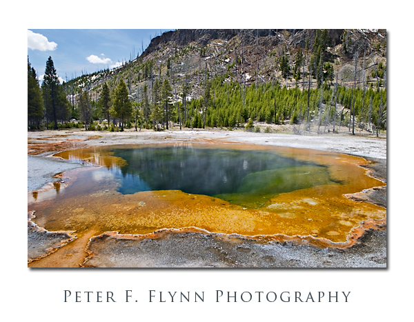 The image above, of Emerald Pool in Black Sand Basin, was recorded at about 13:27 MDT, on May 16, 2010, using the Nikon D3s, and the AF-S NIKKOR 24-70mm f/2.8G ED at 24mm. Exposure was f/16 at 1/10s, ISO 200. Polarizer.
Black Sand Basin contains several excellent pools, including Rainbow Pool and Emerald Pool (which are among the most beautiful hot springs in Yellowstone) and a small but very active feature named Cliff Geyser. Iron Springs Creek runs thought the Basin, generating a starkly dark ribbon of contrast through the light colored volcanic soils. From Black Sand Basin we hiked to the northern section of the Upper Geyser Basin, along the way passing the beautiful Black Sand Pool hot spring, Demons Cave, and the lovely Punch Bowl Spring.
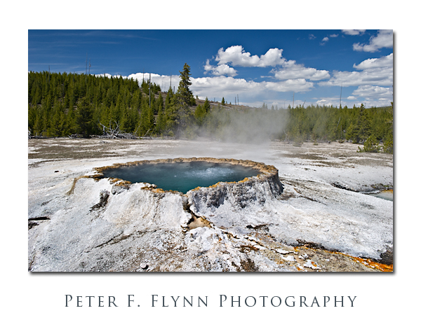
The image of Punch Bowl Spring, shown above was recorded at approx 15:00 MDT on May 16, using the Nikon D3s, and the AF-S NIKKOR 24-70mm f/2.8G ED at 29mm. Exposure was f/16 at 1/50s, ISO 200. Polarizer.
The trail from Black Sand Basin connects with the main path between the northern and southern sections of the Upper Geyser Basin features near the area known as the Daisy Group. From here we walked north to visit the rightfully famous Morning Glory Pool, and then south, past Chromatic Spring and Beauty Pool to Castle Geyser.
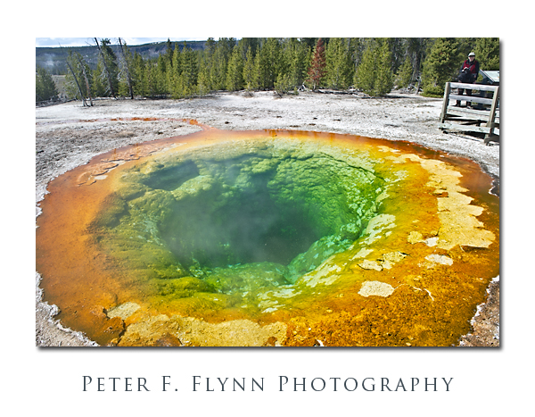 The image above of Morning Glory Pool with the HP in the upper right hand corner, was recorded at around 15:30 MDT on May 16, 2010, using the Nikon D3s and the AF-S NIKKOR 24-70mm f/2.8G ED at 24mm. Exposure was f/16 at 1/25s, ISO 200. Polarizer.
A completely awesome interactive map of Yellowstone geysers has been developed by The Geyser Observation and Study Association (GOSA) – find it here. A very complete and easy to read map of the Upper Geyser Basin thermal features appears here.
Copyright 2010 Peter F. Flynn. No usage permitted without prior written consent. All rights reserved.
